Sirimon Route
Author: Martin Linhart
Photos: Martin Linhart | Ladislav Lenc | Pavel Oplt
Tags: 2010 | Afrika | Keňa | Mt. Kenya | Sirimon | UNESCO

Tired after yesterday, we went to bed soon. At night the wind was blowing pretty strong and in the morning the temperature inside our tent was -6 °C.
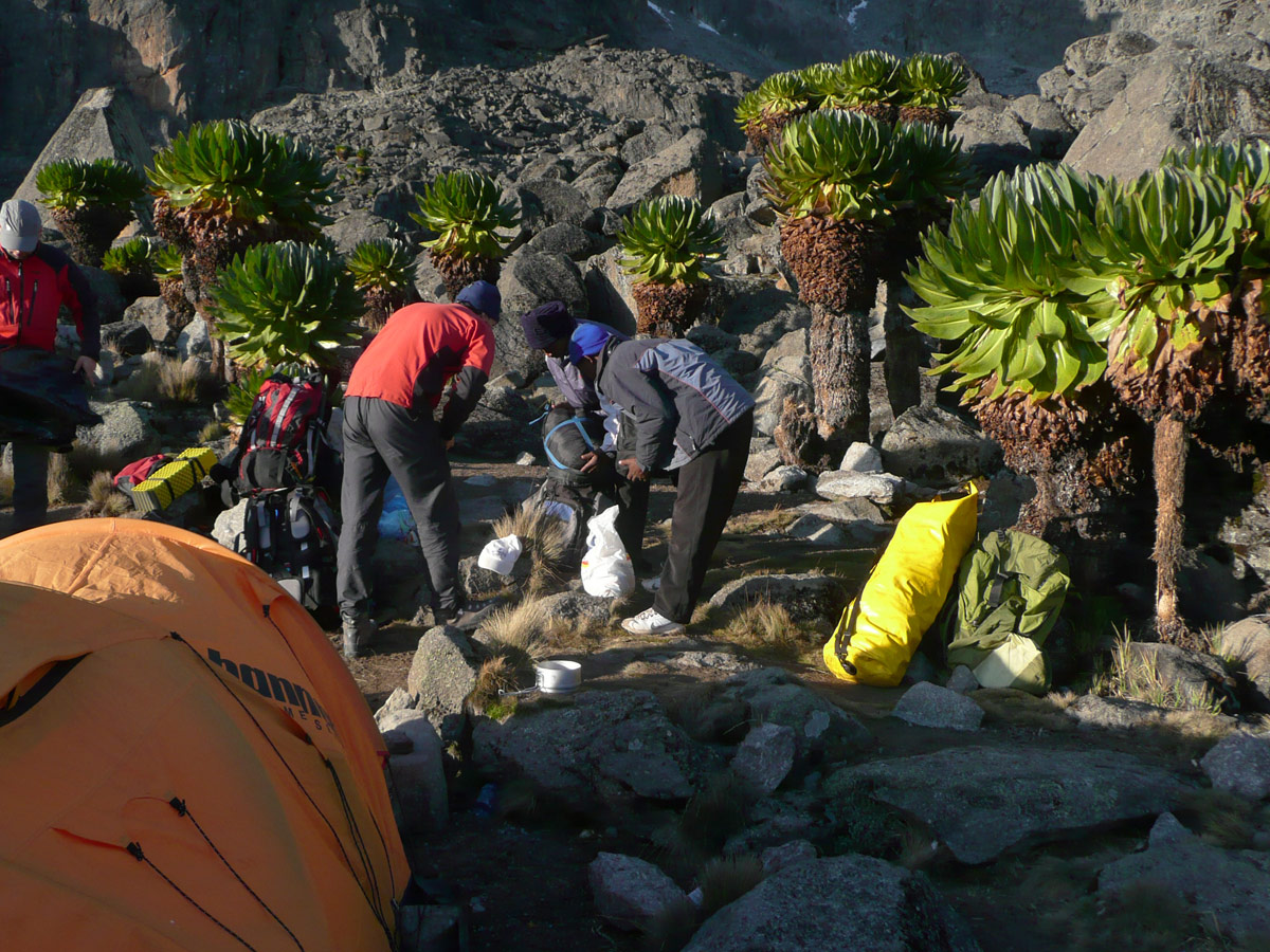
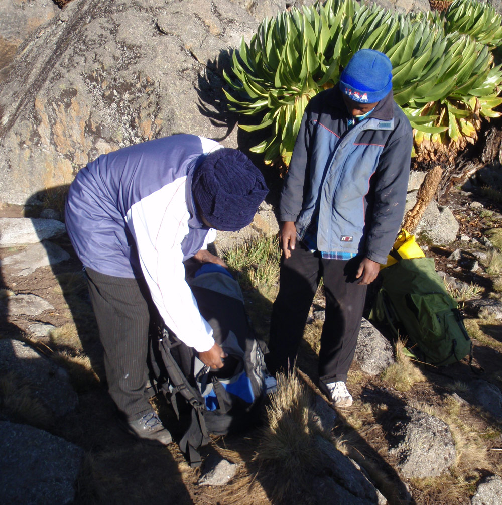
We don’t feel like getting up. We slowly prepare tea and get out only after the first sunrays have touched our temporary dwelling. The carriers are on time. Business is business and even in Africa it apparently doesn’t pay to be late.
.")
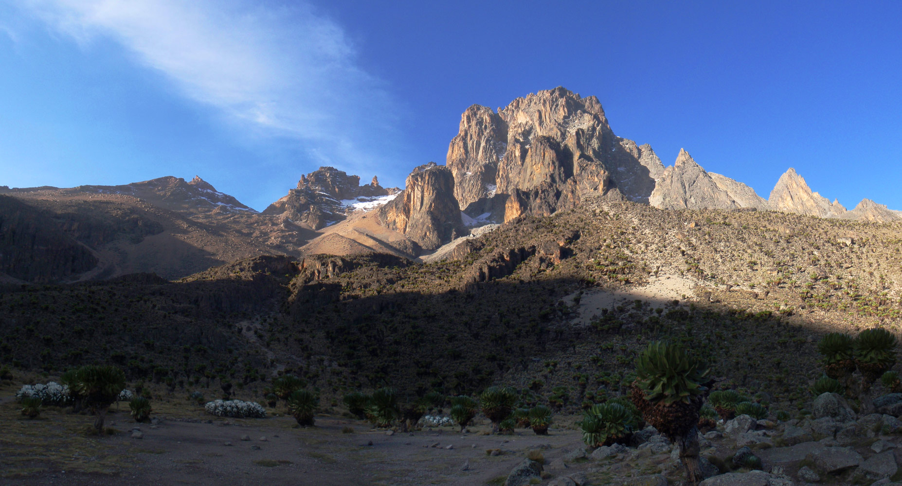
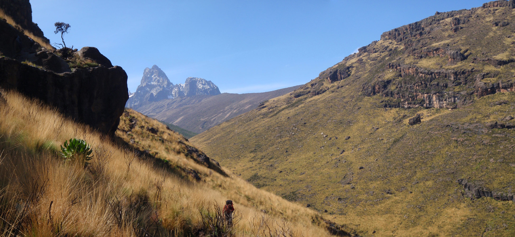
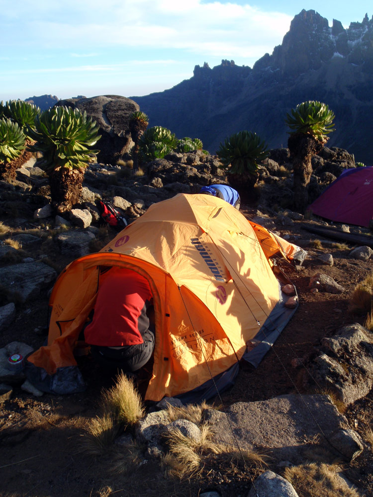
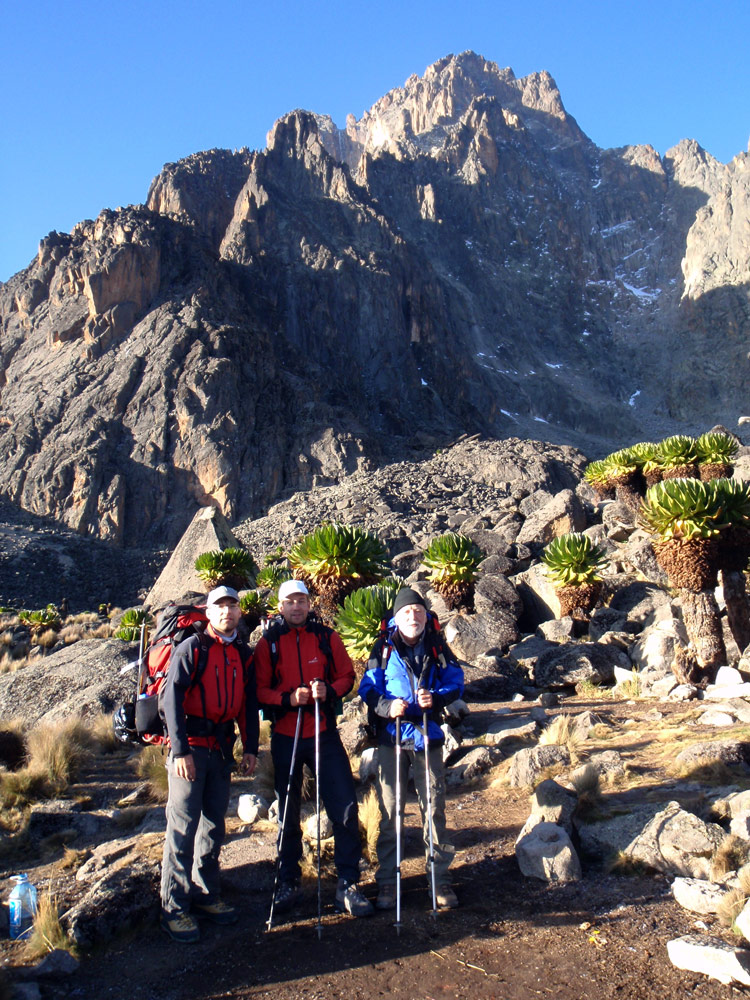
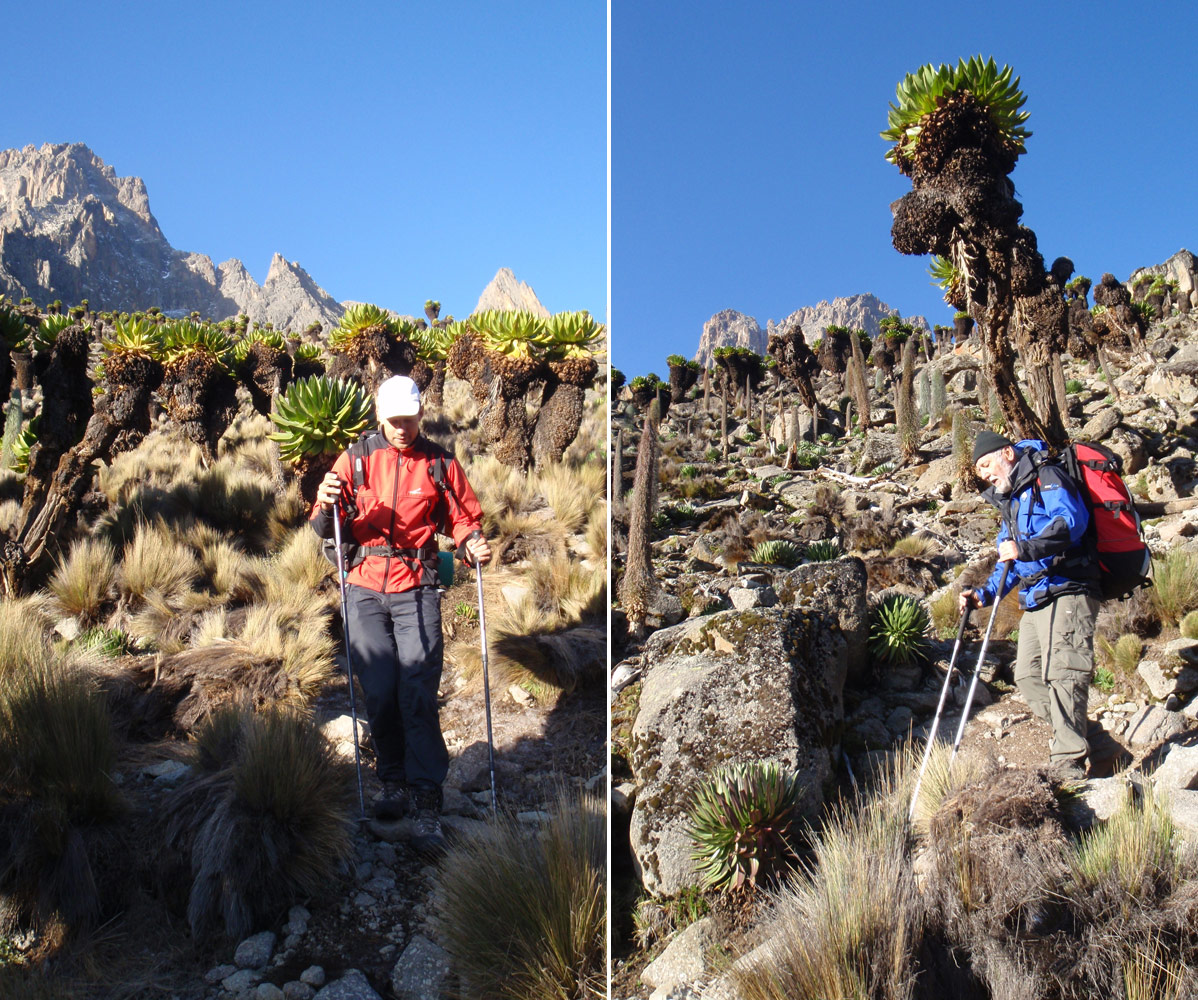
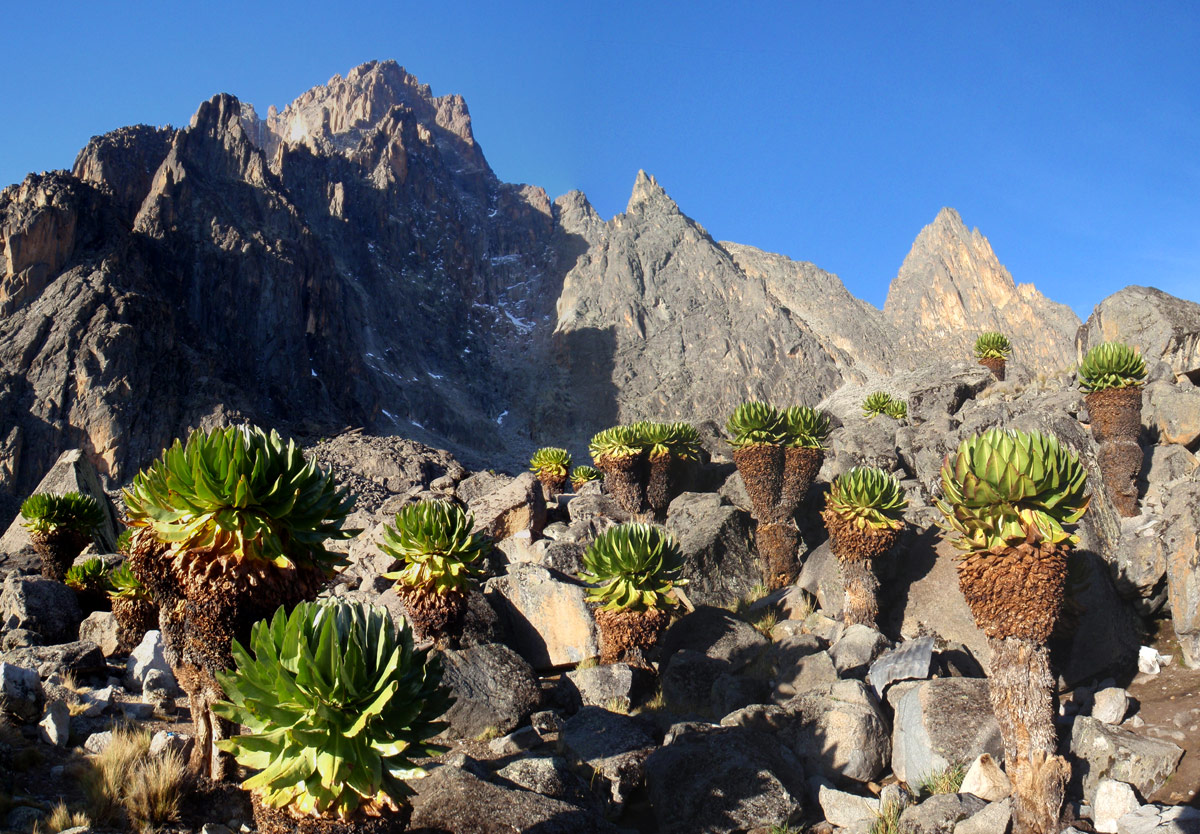
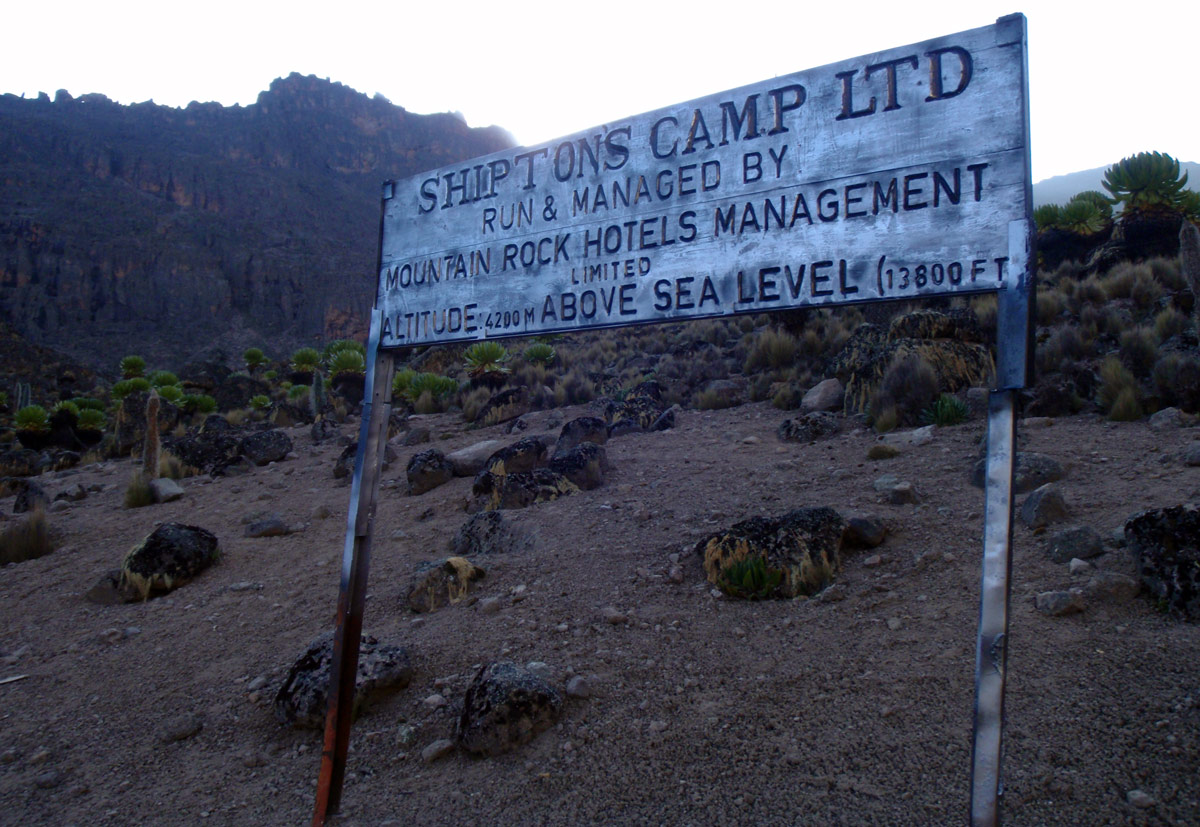
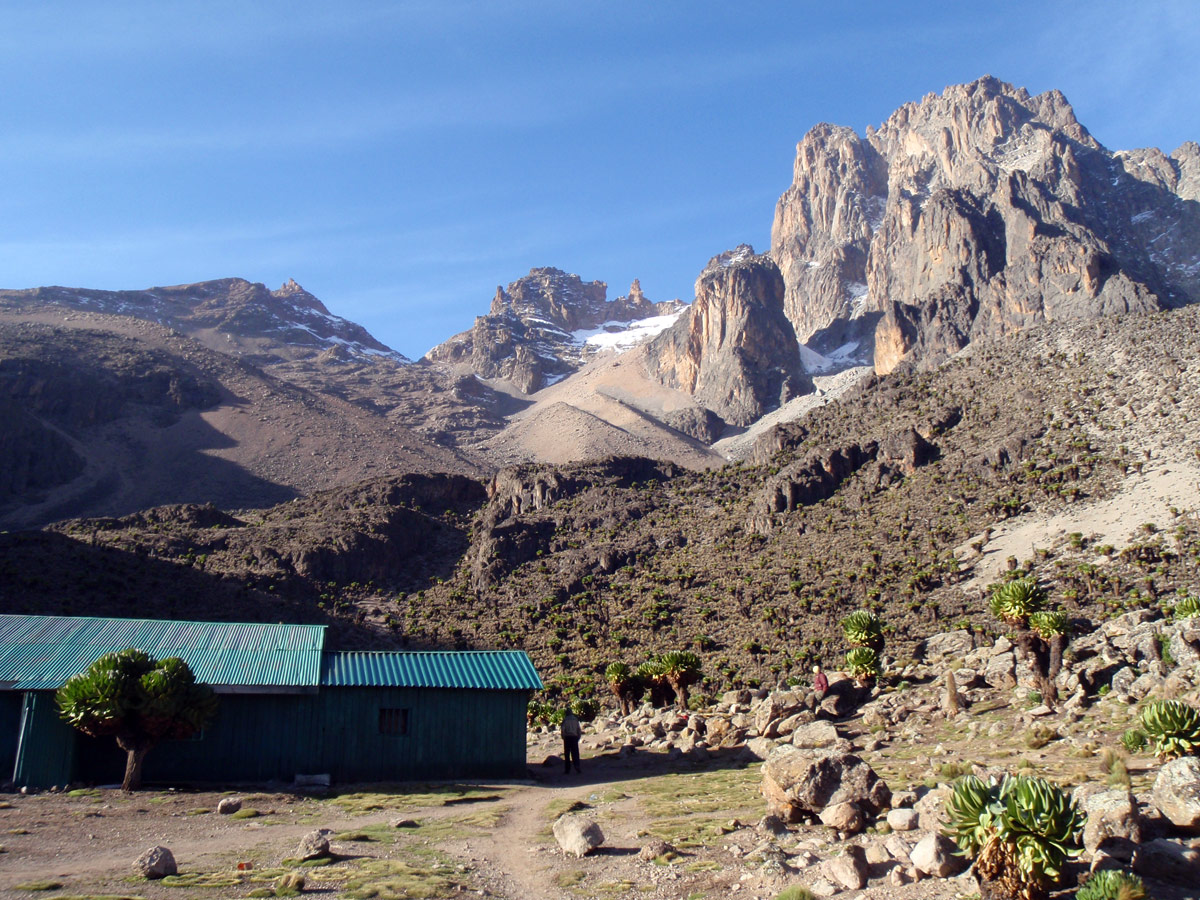
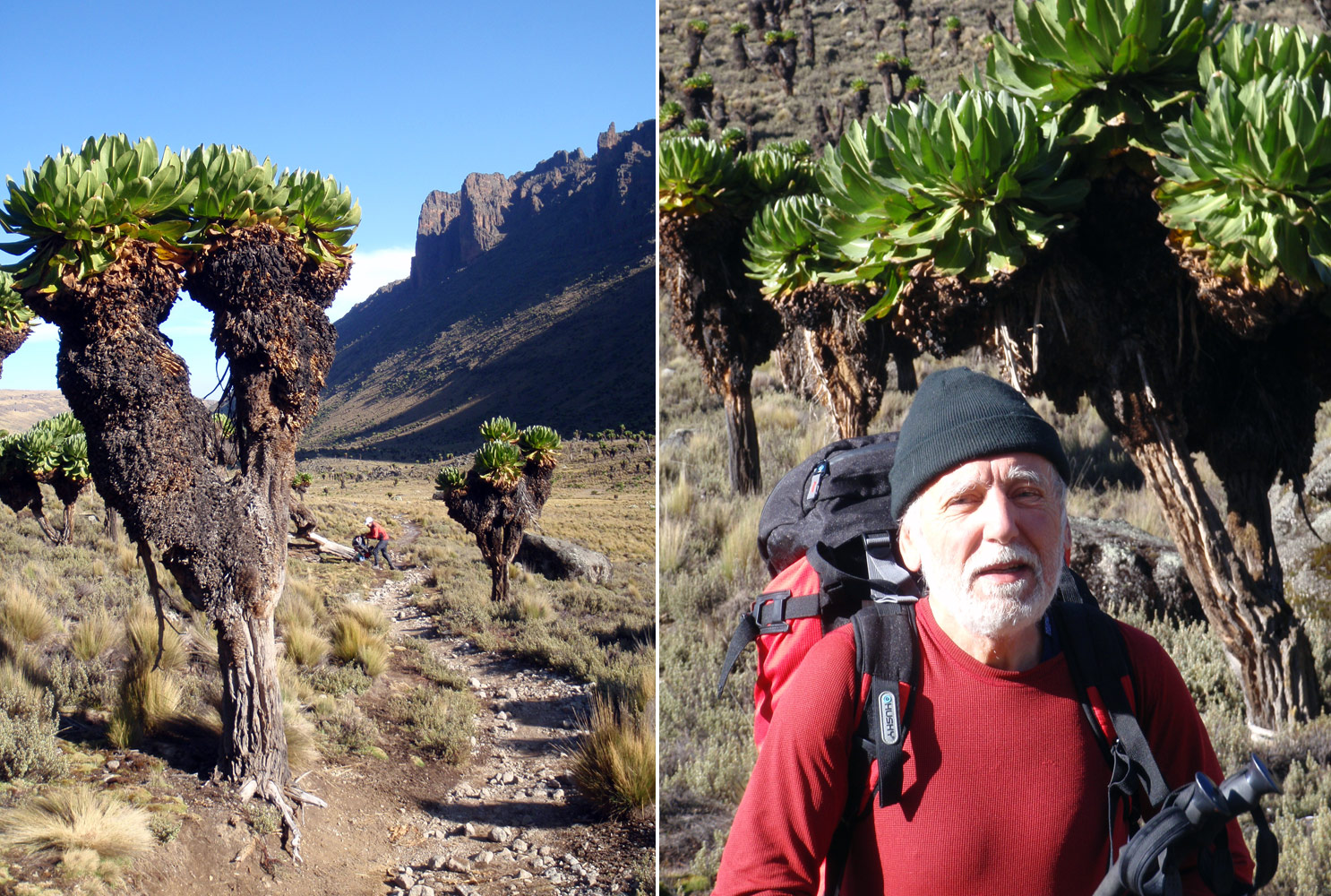
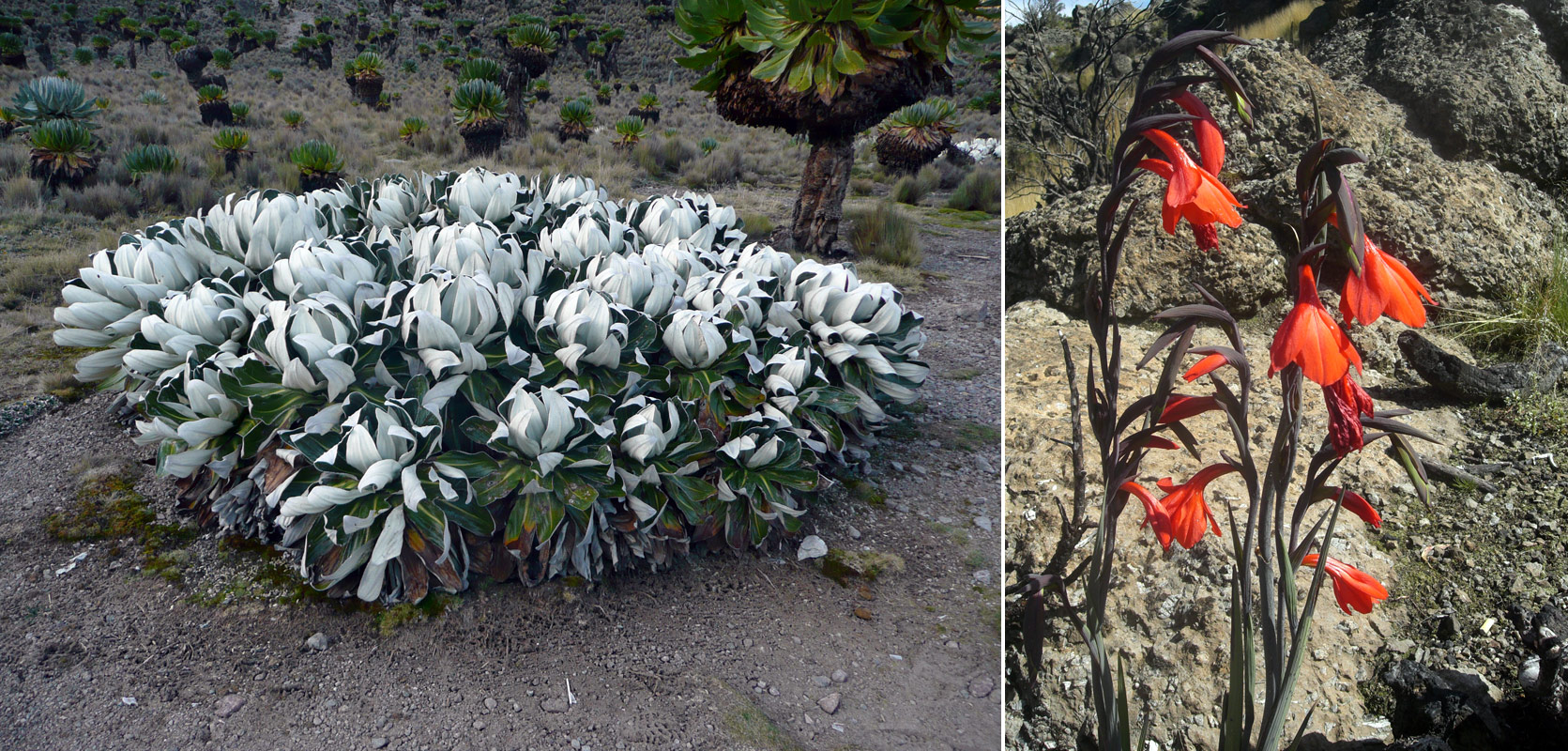
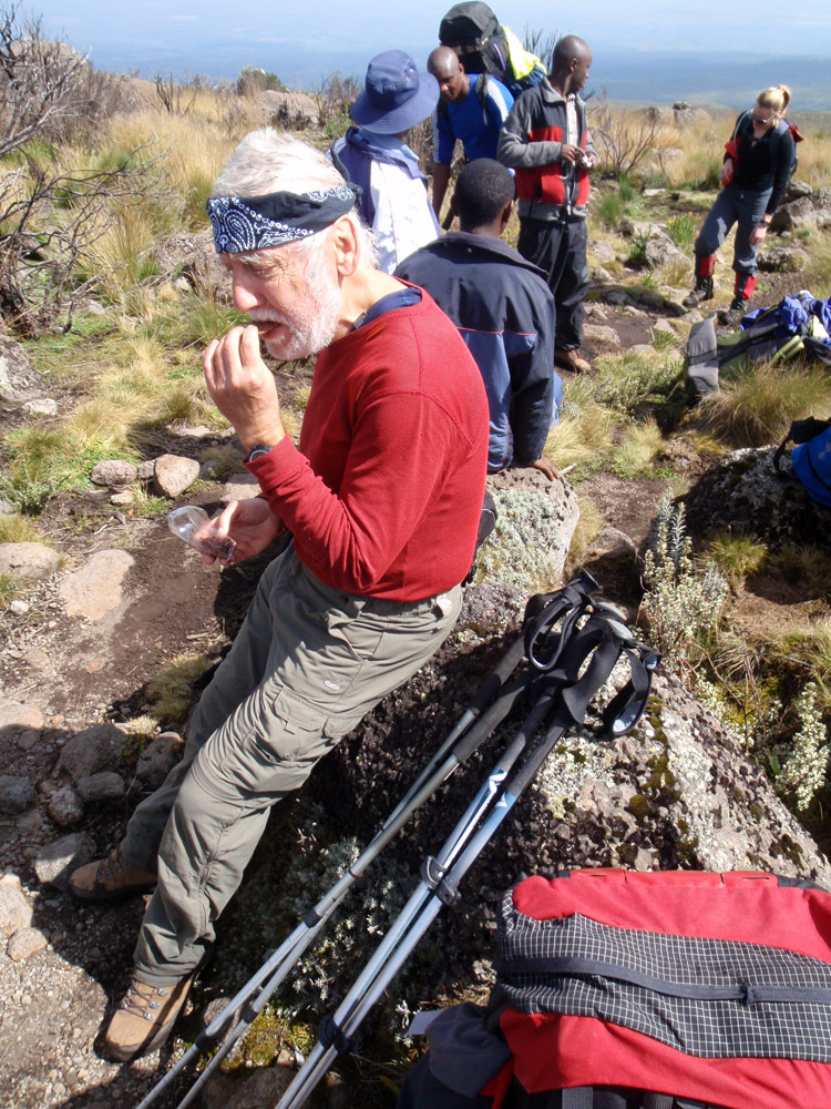
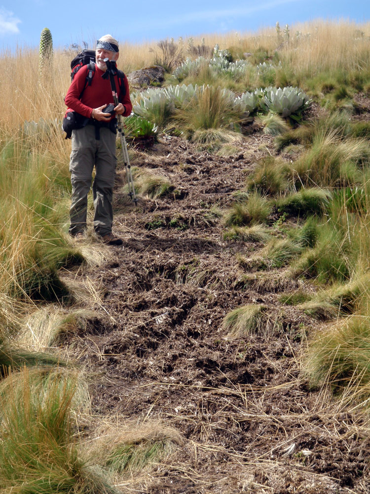
Journey to Shipton Camp (4236m) is short. Only a few hundred metres down the hill surrounded by tall lobelia. As it happens, even at such a short walk, anything can happen. This time, bad luck for Pavel. He overlooked a bit of icy trail and slipped. Nothing serious, fortunately. Fatigue is already perceptible and we have no idea what awaits us today!
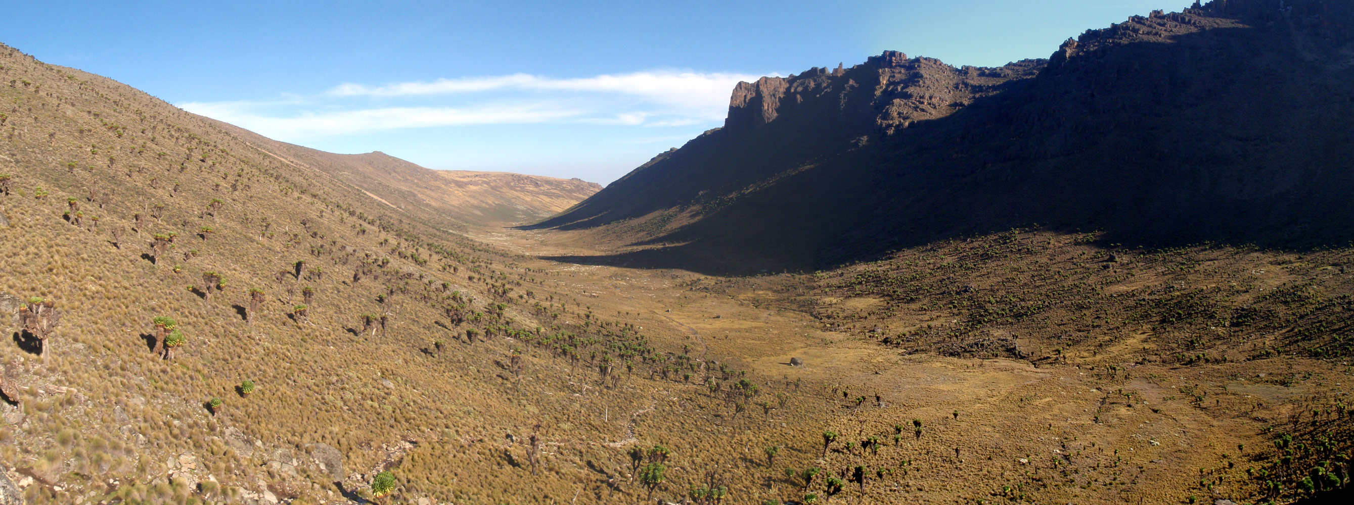
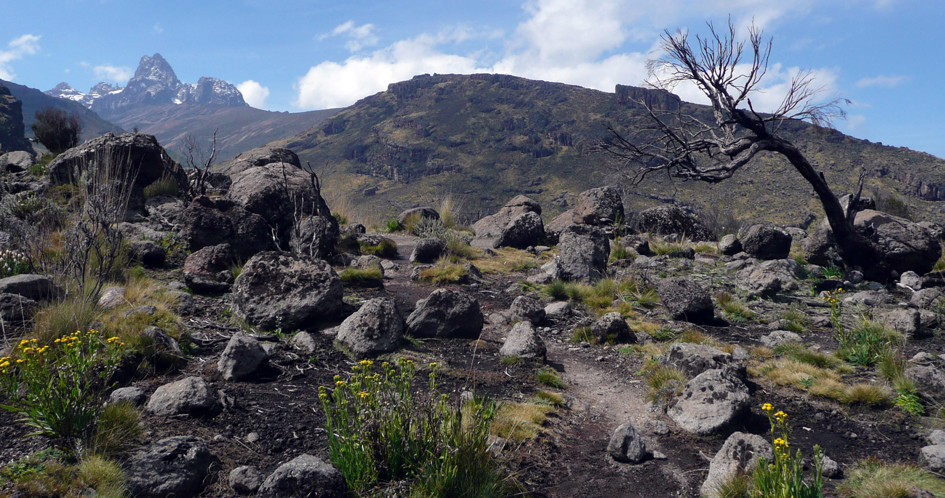
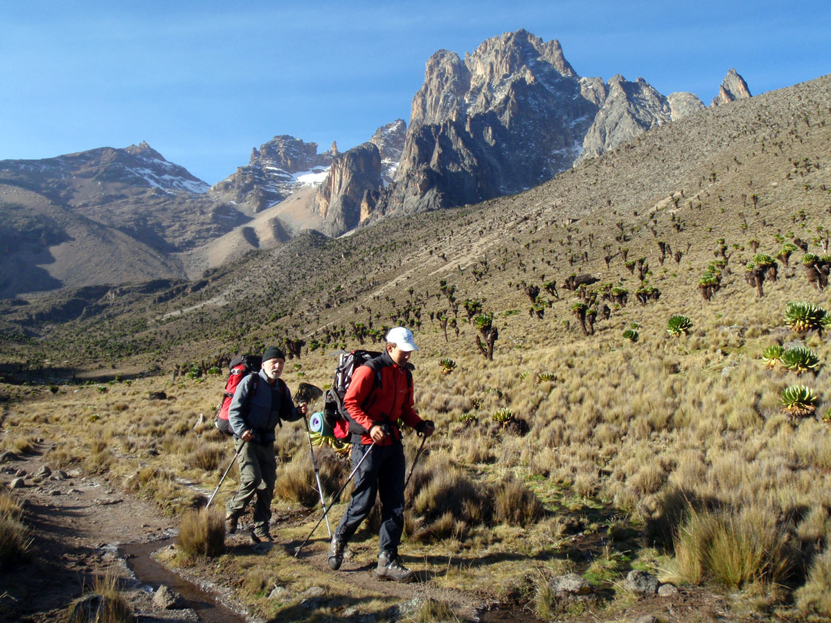
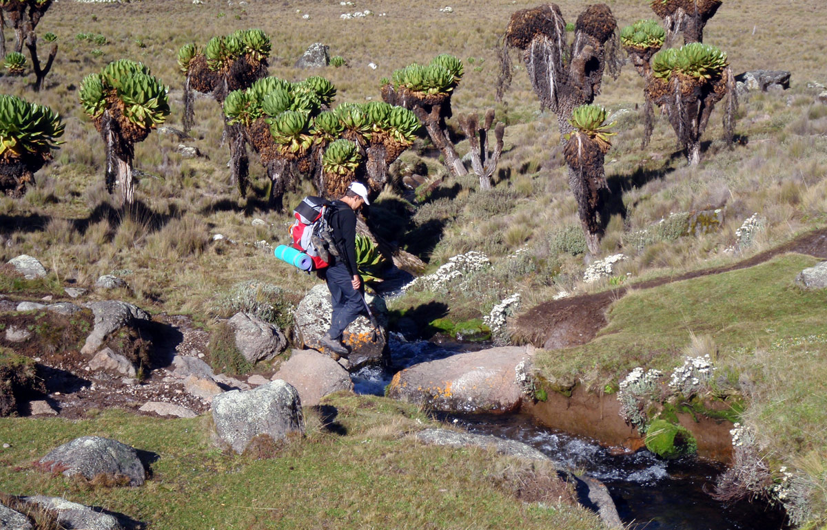
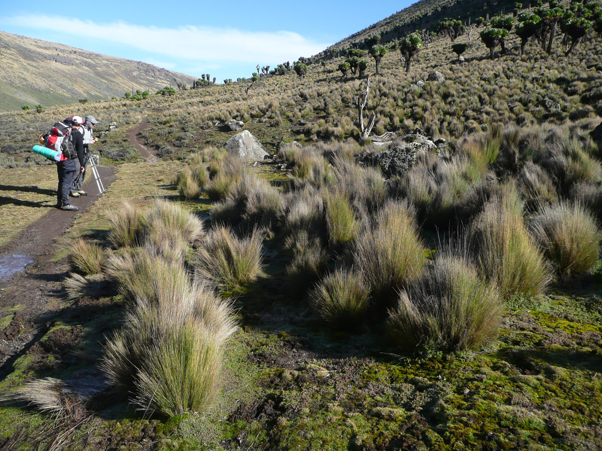
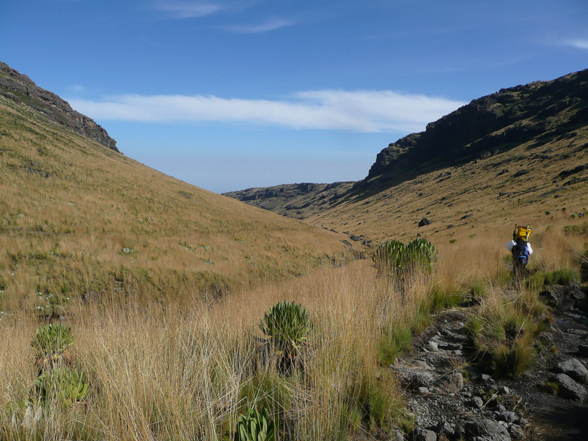
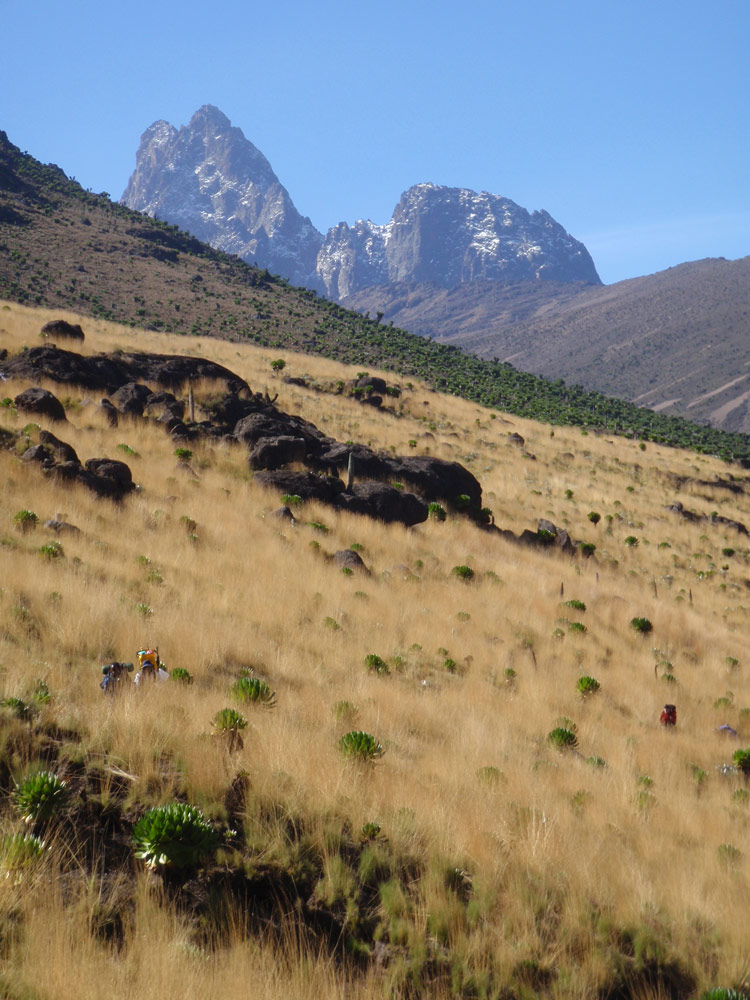
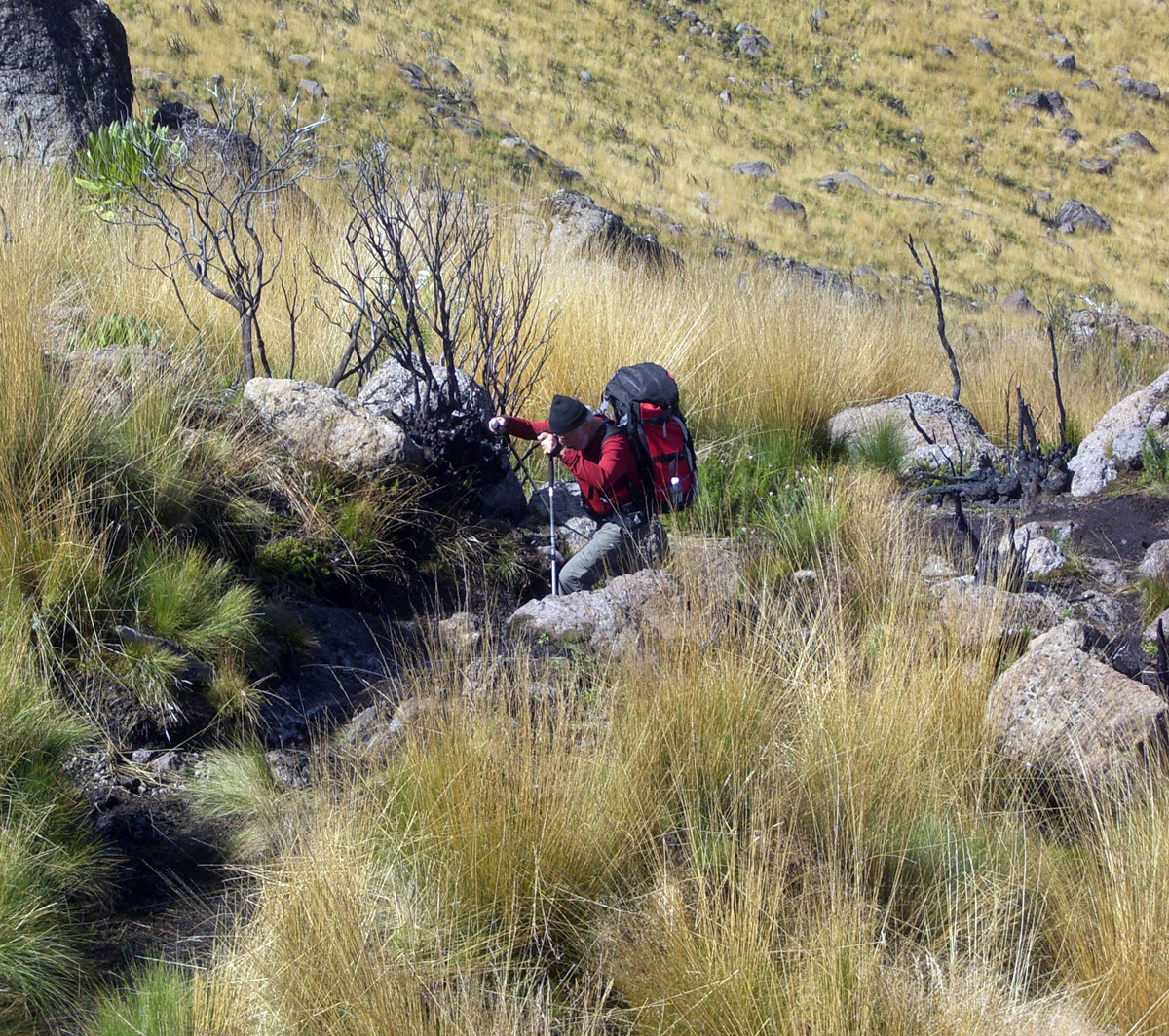
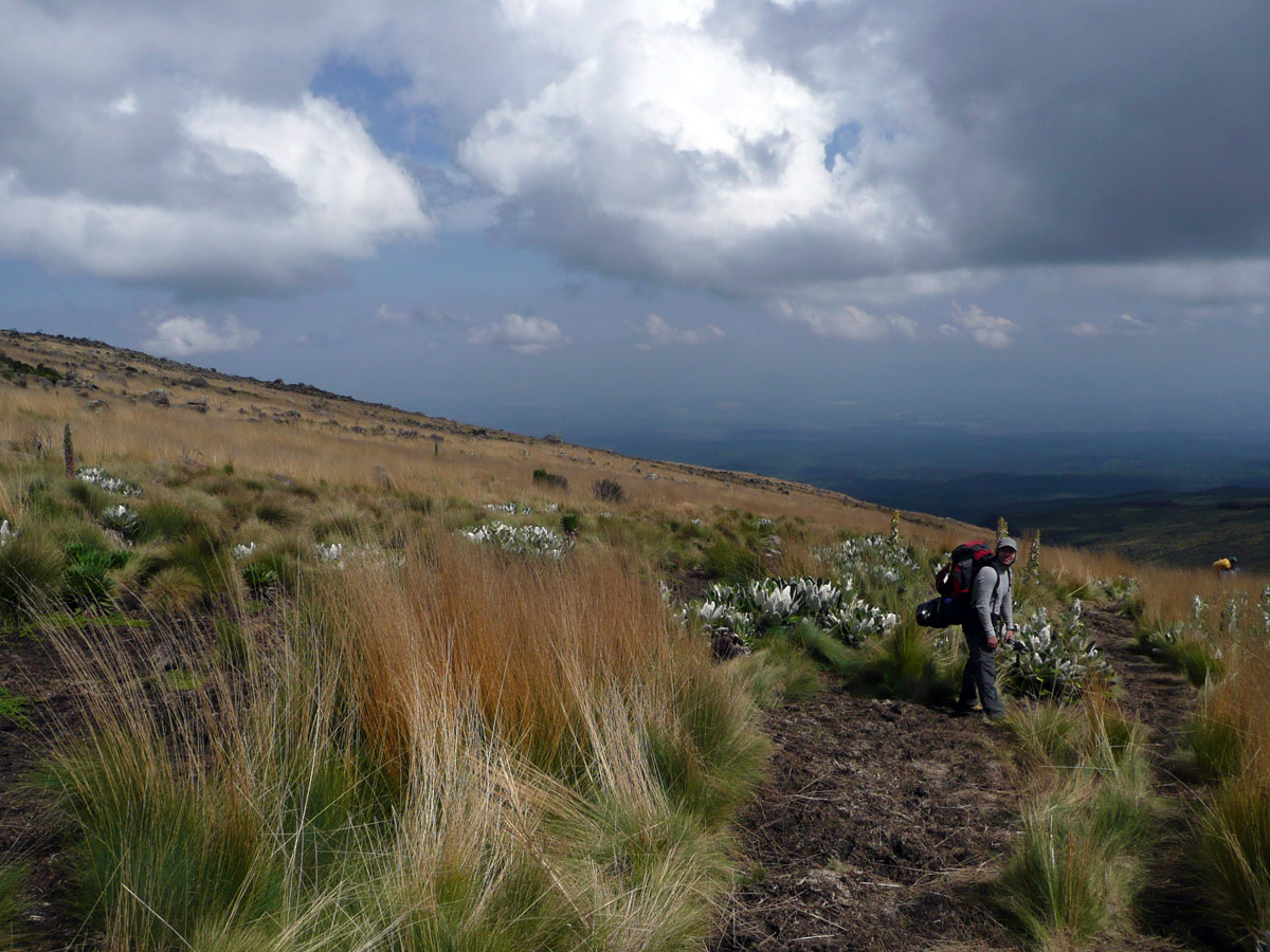
After eight o'clock we head towards the gate (Sirimon Gate – 2650m) - the objective of today's march. We have the Mackinder's Valley stretching in front of us. We go first but it’s clear that carriers will soon catch up. We literally enjoy the first few kilometres. The path drops only slightly and the massive lobelia keep accompanying us. Only occasionally there’s a small stream to cross. The change comes after a rocky fracture. Lots of water around, marshes, swamps and even though the ground is covered by icy crust after a long night we sink very often.
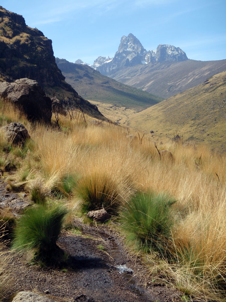
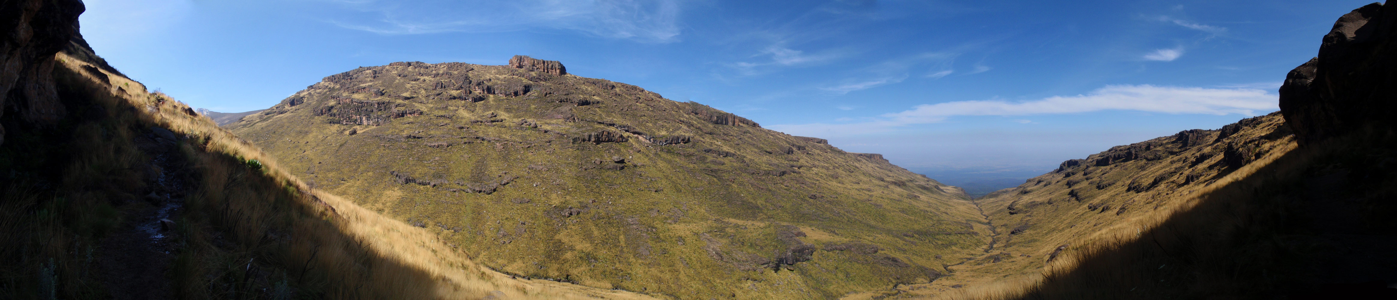
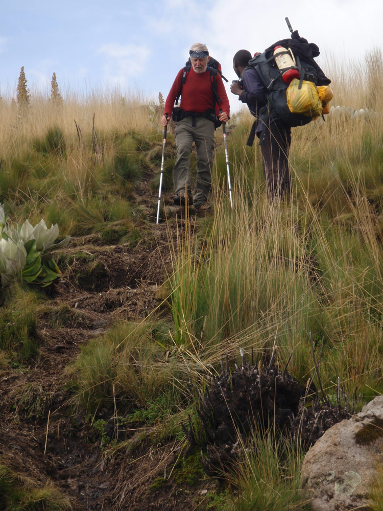
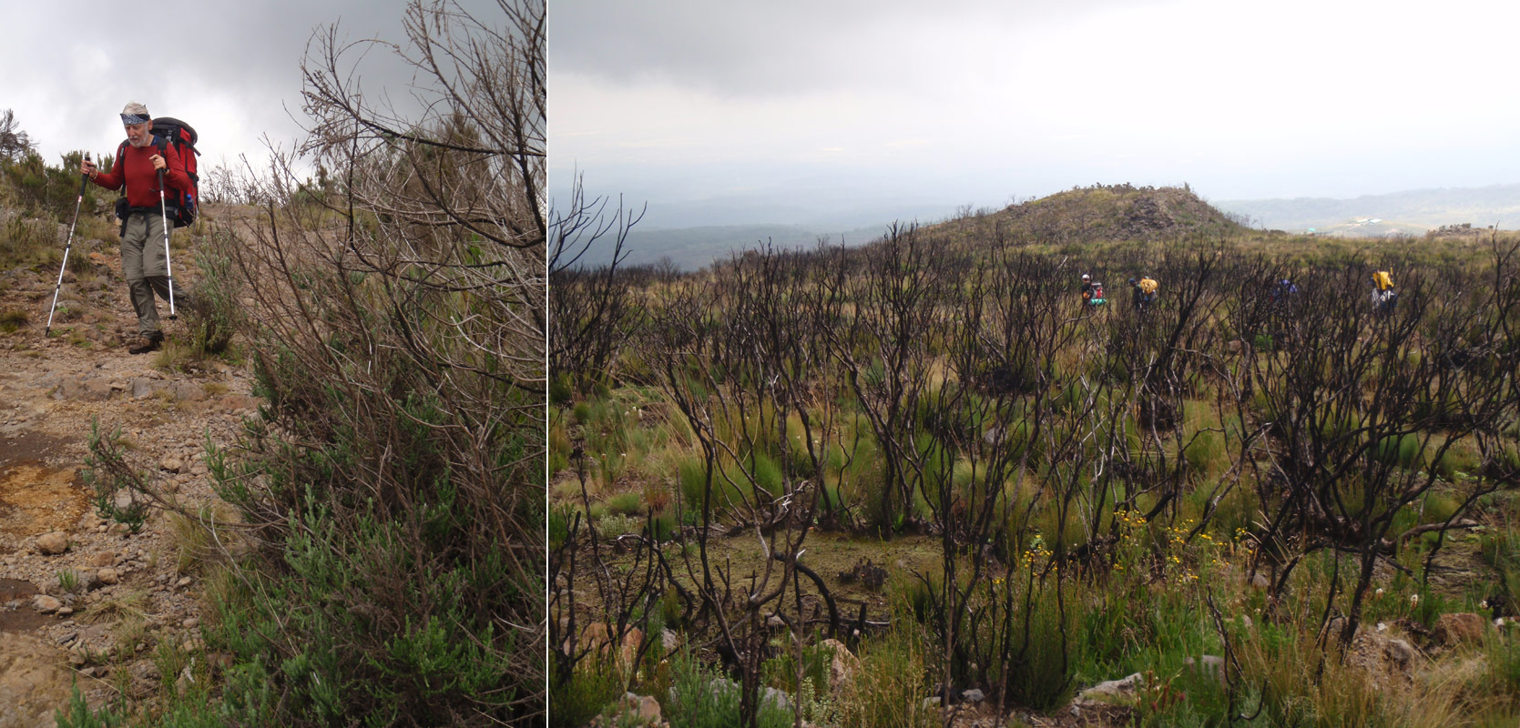
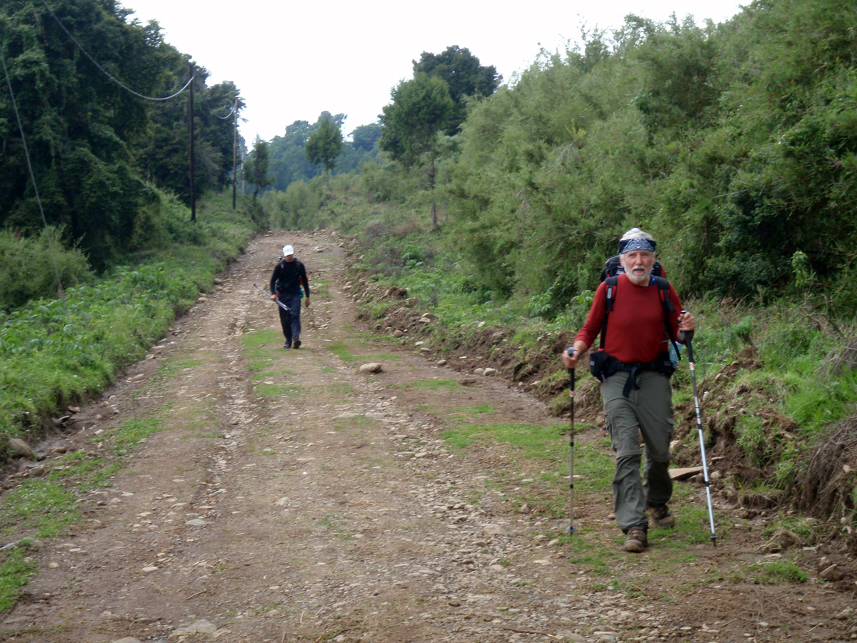
The road takes a right turn and climbs slightly. We leave the Liki brook valley. For the first time in five days, we meet a group of tourists. Compared to their tiny backpacks, we look like carriers. In the next three hours we pass one group after another. Comparing with Chogoria we don’t like the Sirimon Route at all and don’t understand why so many crowds our flowing up this route.
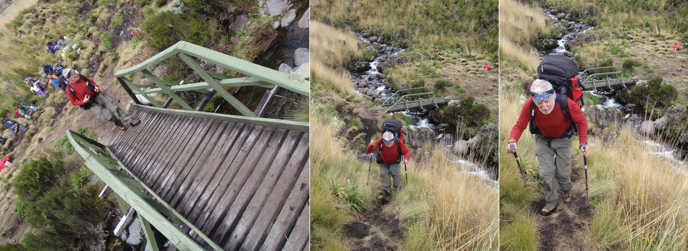
Up and down the muddy trails, the first and second small valley behind us, including crossing the Liki North stream via a perfect bridge, and Ontulili stream. And we can see the roof of the hut in certain distance.
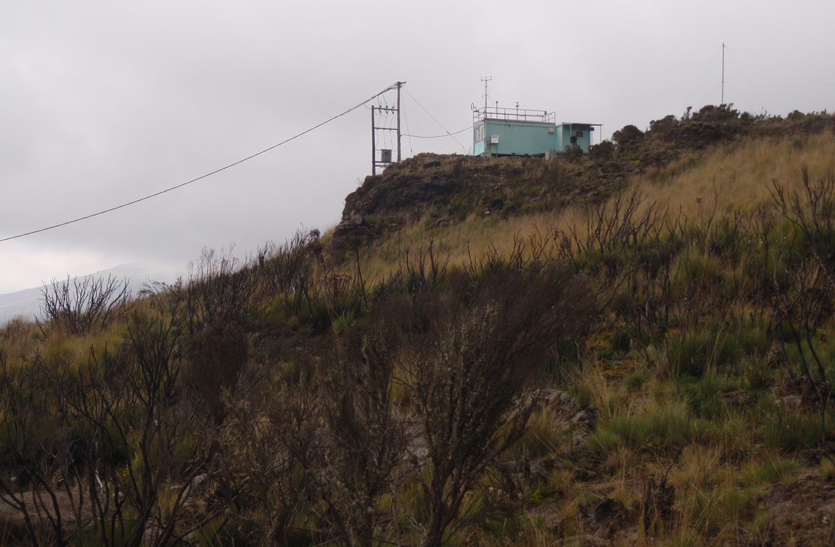
The march is getting unbearably long and arduous. We have to make another short break; we are at the junction where the trail via the Liki North Camp (3993m) joins the ours, at the weather station building.
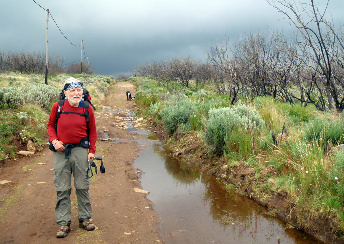
In a half-hour the last segment in muddy terrain is behind us. We cannot understand why are we stained by mud up to waist and our carriers don’t have a single dot at their trousers. The guys go so light - in their casual city trousers and shoes, with umbrellas, getting over muddy soils as if they didn’t notice them at all.
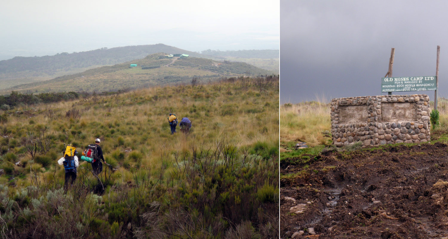
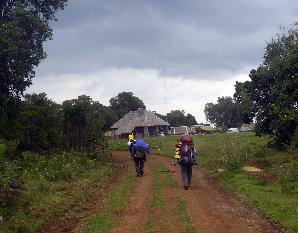
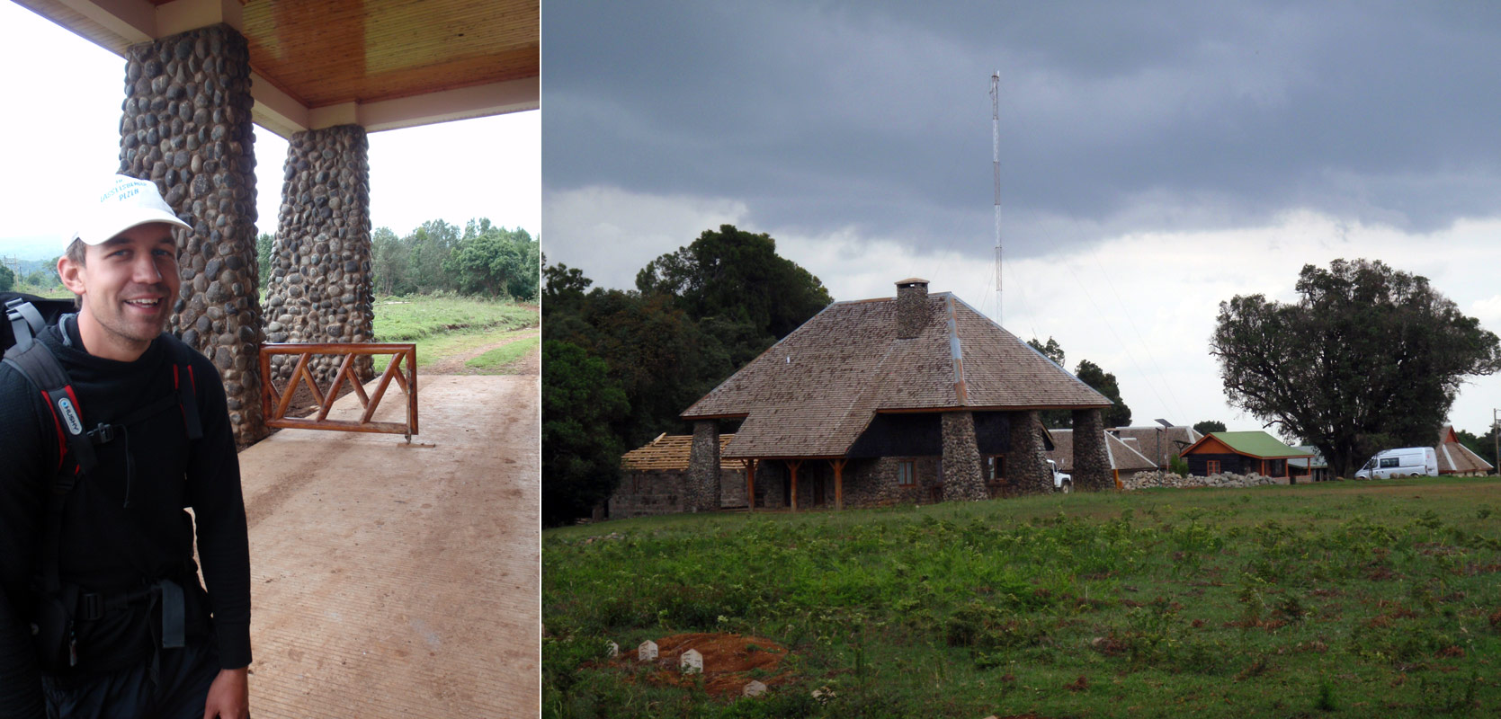
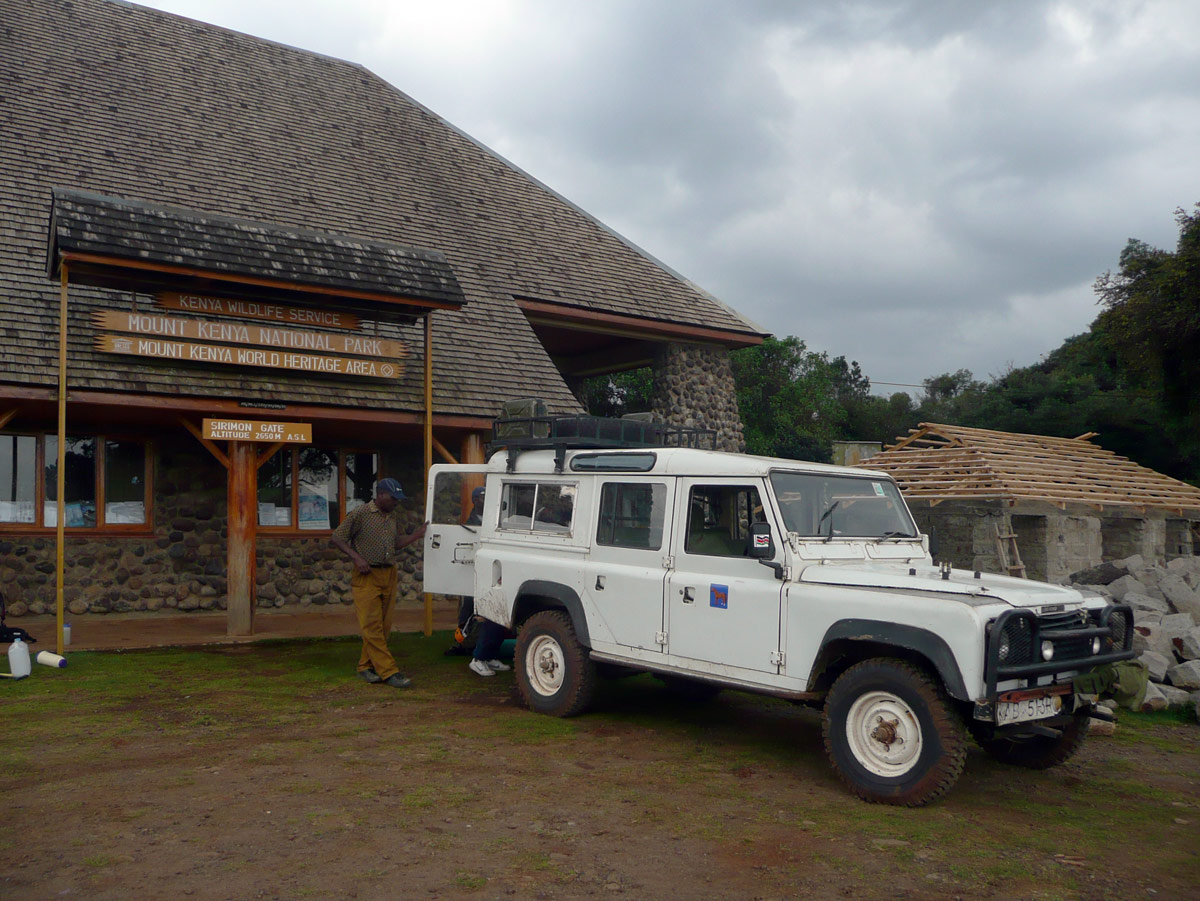
We're at the Old Moses Hut (3300m). It is possible to make it by jeep up to here from the park gate. Obviously, a car is not an option for us. We enjoy walking also the last nine-kilometre section of paved trail.
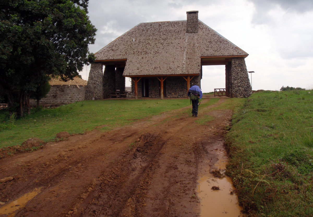
The sensation of happiness when passing the gate is indescribable. More than seven hours of walk, 1800 metres of descent on 23 kilometres and only few minutes for breaks. We almost didn’t eat or drink. Only Lada keeps his good mood, which is fine, because someone has to go negotiating with the rangers about the rest to be paid for staying in the national park.
And Lada is in a damn good condition! For the talk with the young and until that moment watchful female ranger he rolls out his white-white smile and deep blue eyes. The result is awesome - even though we exceeded our stay in the park by four hours and should thus pay two extra days, Lada manages to cut it by half. So we pay only 55 dollars each. Magnificent performance!
Sirimon Route
. Zdroj: Cameron M. Burns, Kilimanjaro & East Africa, A Climbing and Trekking Guide, The Mountaineers Books")
Ideal starting point is the town of Nanyuki (1980m) on the northeast side of the mountains. The distance between Nanyuki and Sirimon Gate is 25 km. Out of this, 9 km on "dirt road". The turn from the main circular road around the massif of Mt. Kenya is well marked by large wooden sign.
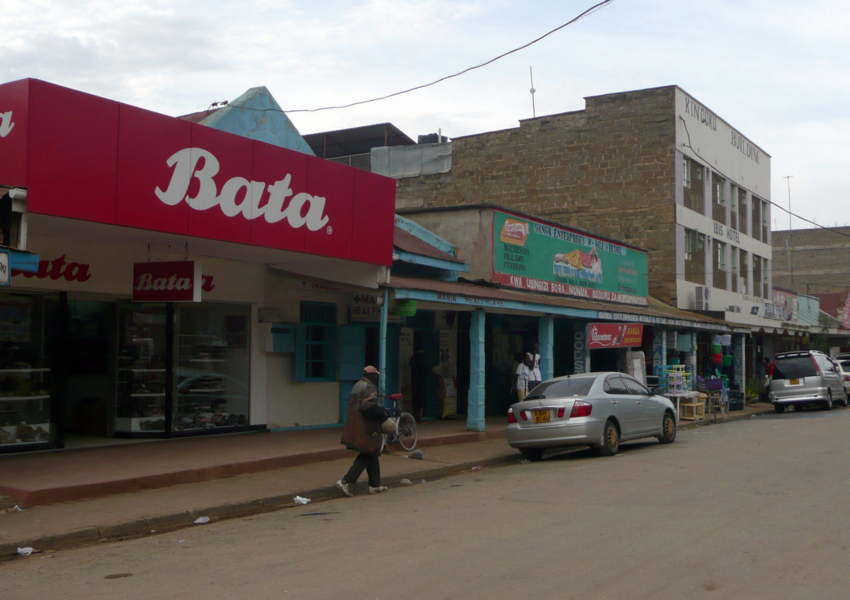
In Nanyuki there’s no problem finding hotels or carriers. But we still recommend booking the hotel in advance. Given how popular the route is, it may well happen that the cheaper hotels are fully booked in the season.
1st day: Sirimon Gate – Judmaier Camp/Old Moses
Distance: 9km
Duration: 3 - 4 hours
Distance 9 km through the jungle can be made quite comfortably in Land Rover. There are, however, enthusiasts who, for the sake of better acclimatization, go on foot. And they are right to do so.
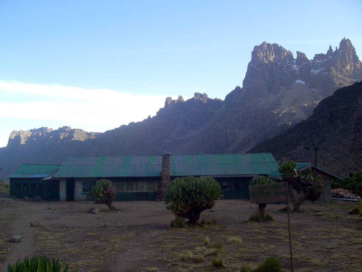
Most of people spend their first night in the National Park in the Judmaier Camp. The more affluent continue just a few hundred metres further to the Old Moses Hut.
2nd day: Judmaier Camp/Old Moses – Shipton´s Camp
Distance: 14km
Duration: 5 - 6 hours
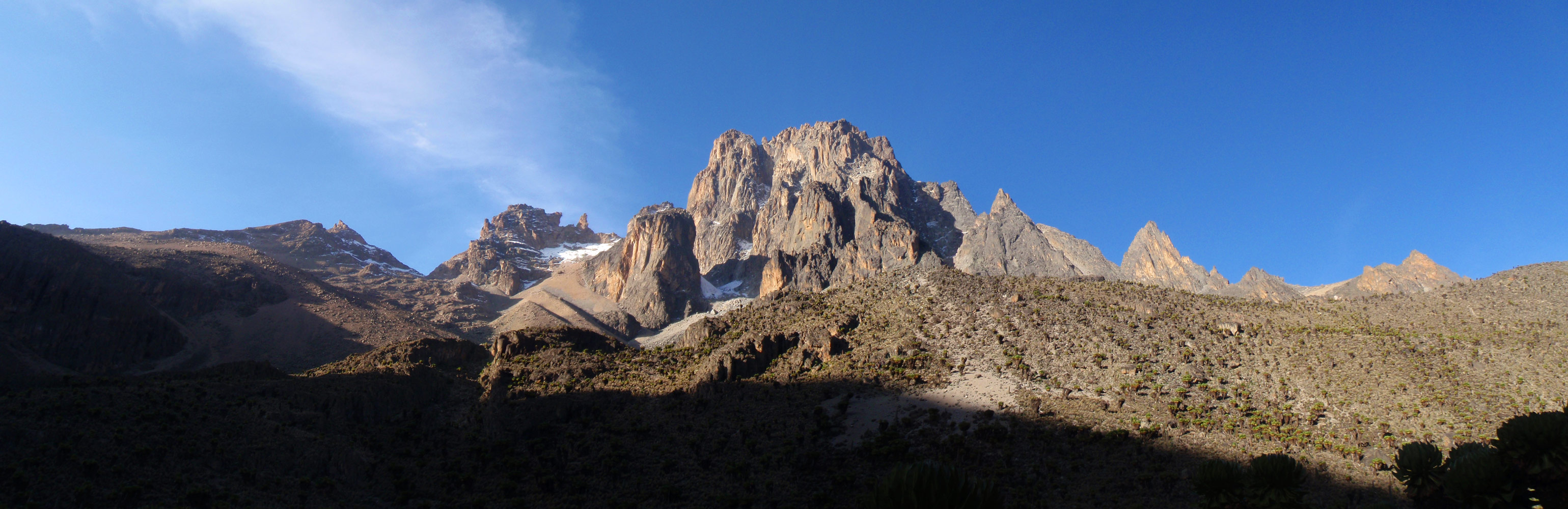
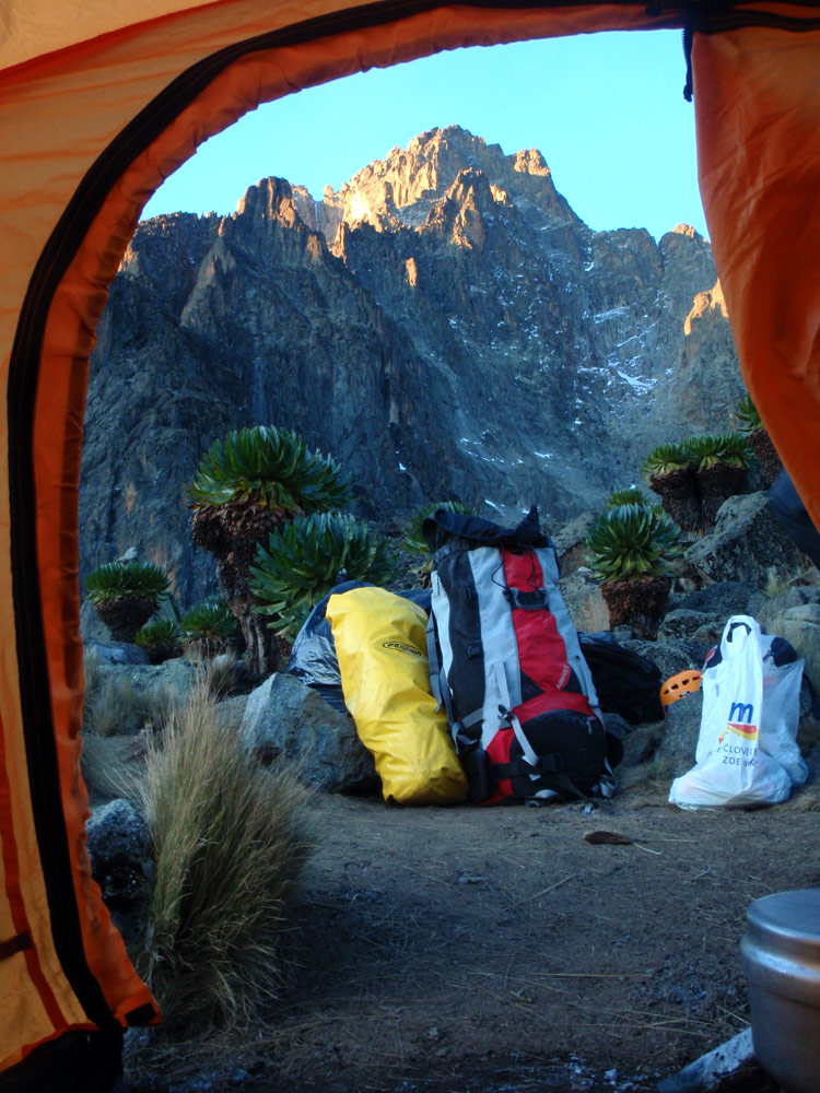
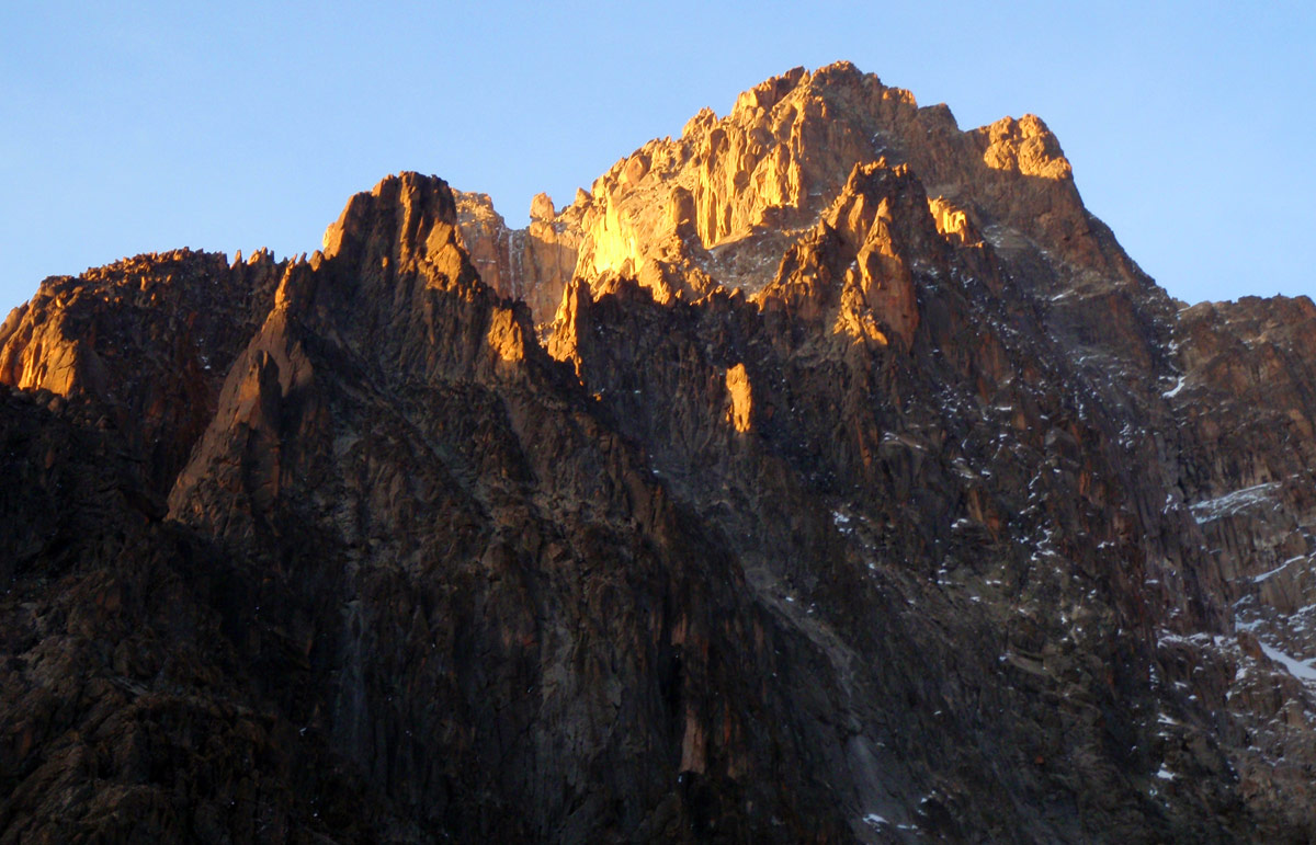
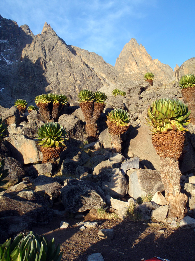
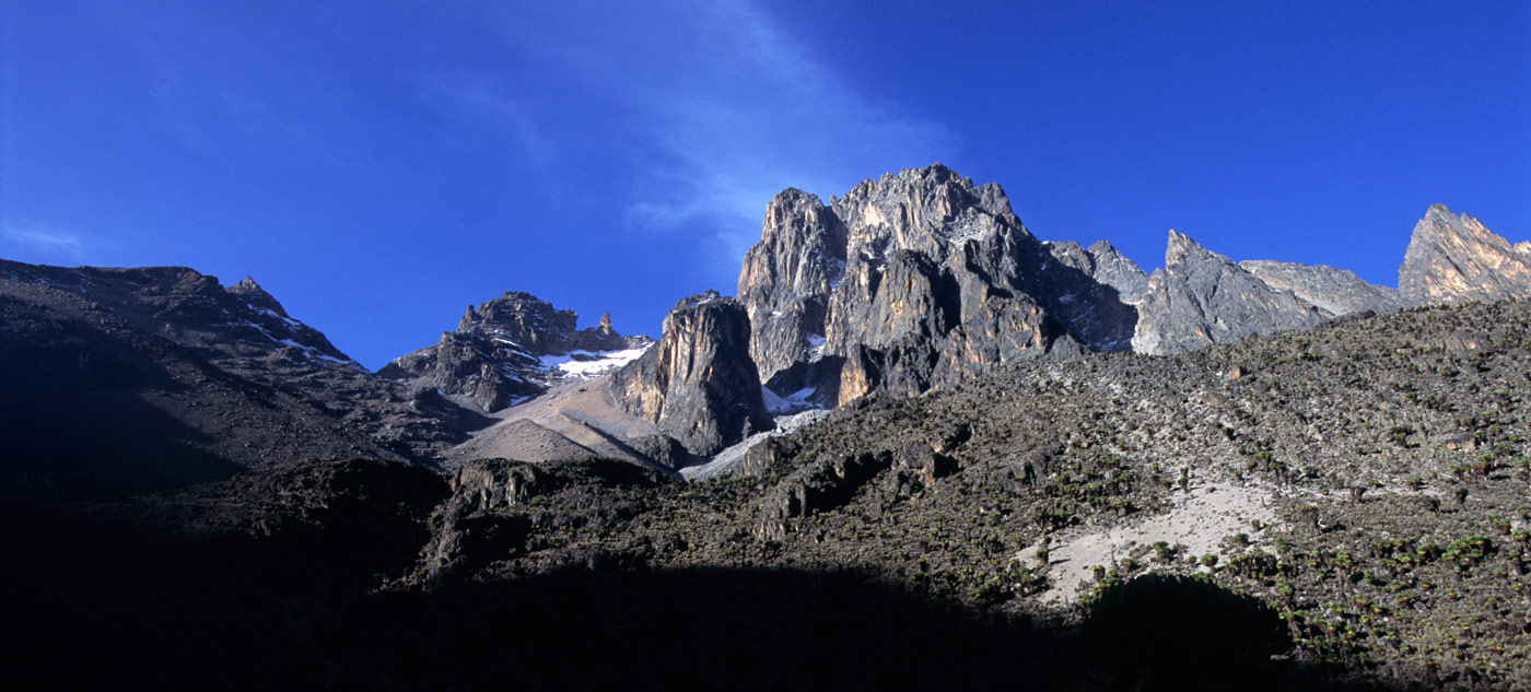
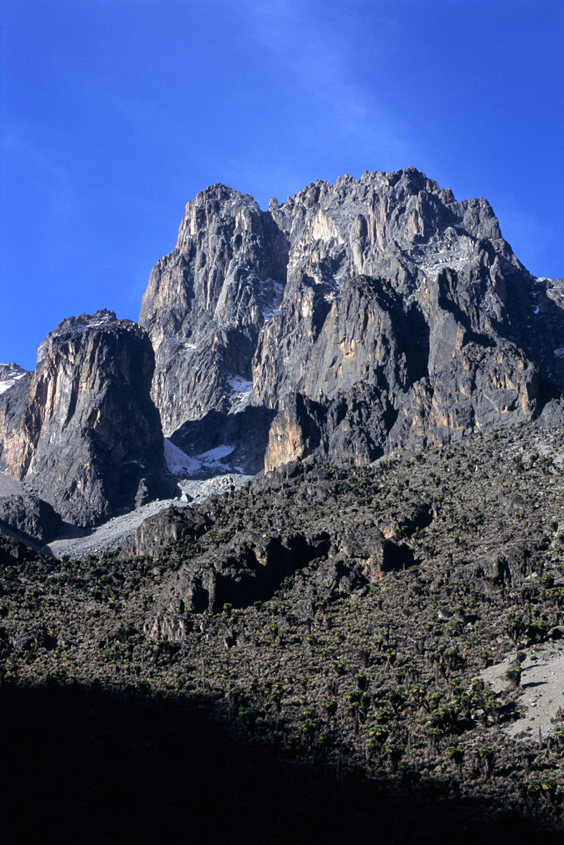
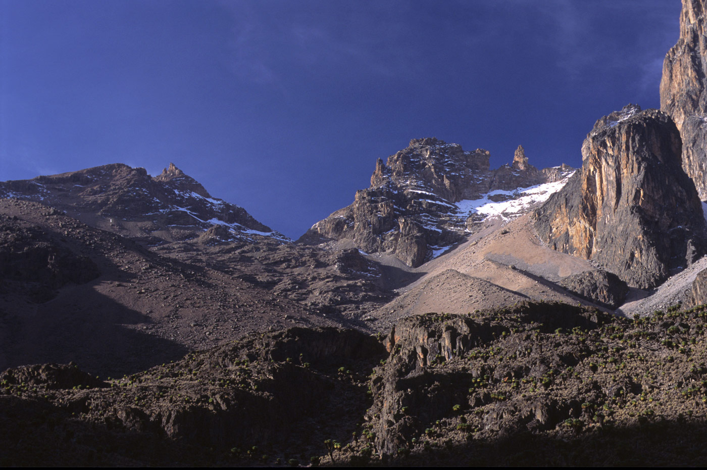
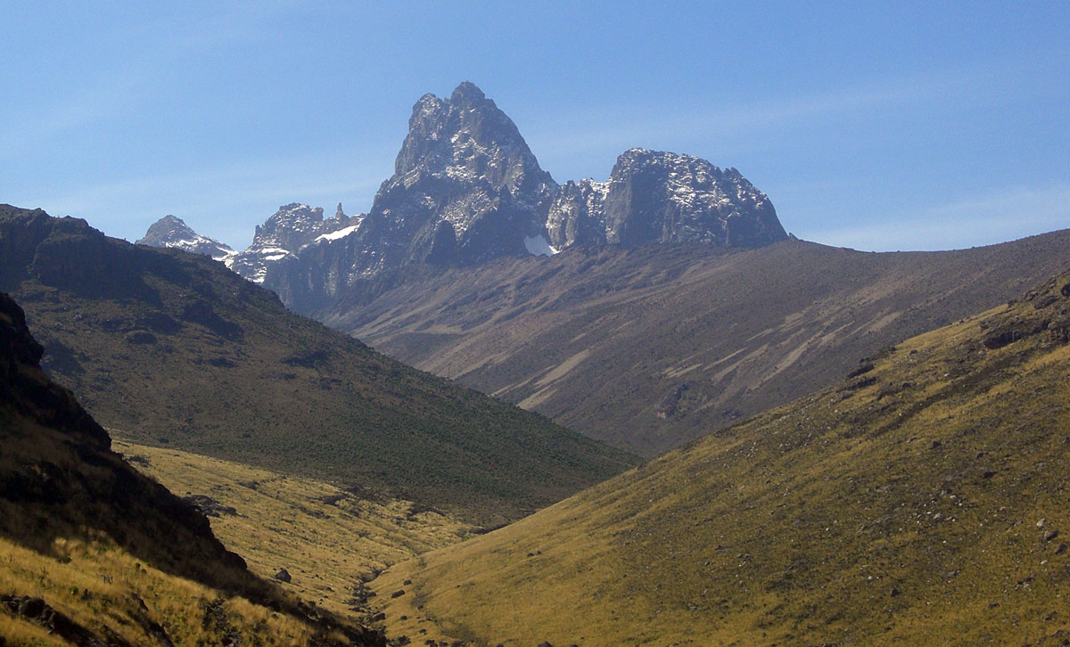
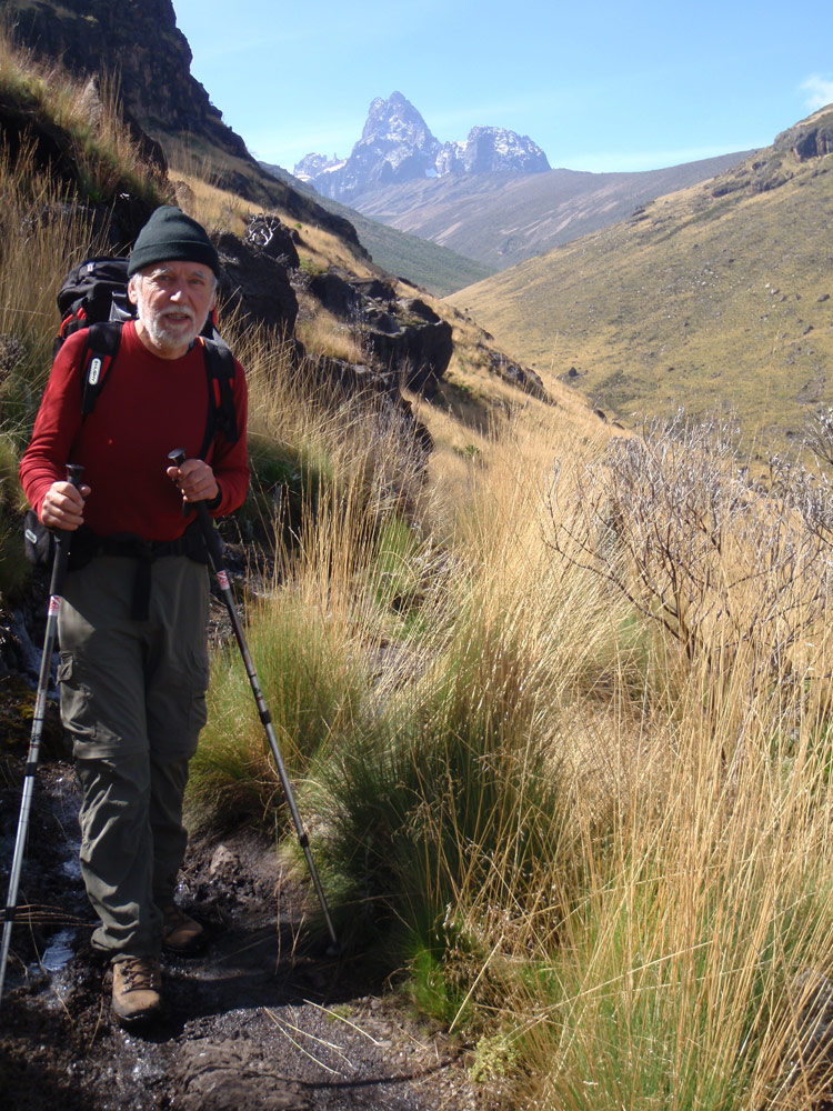
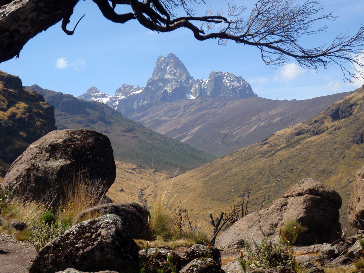
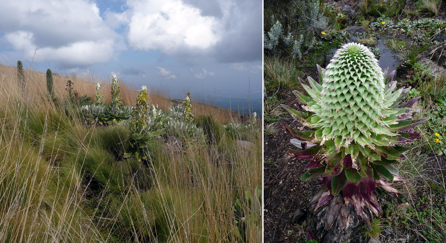
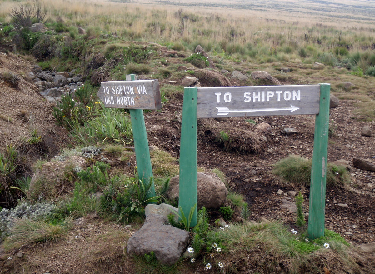
From Old Moses Hut, visitors can observe Batian and Nelion and some other peaks of the massif. Apart from enjoying the view, you also have to make a choice of path to follow. There are two options: Mackinder valley or via Liki North Camp (3993m). The road splits at the meteo station (GAW - Global Atmosphere Watch). The vast majority of people bet on the easier route through the valley and turn right. Don’t be surprised if you choose the Liki North option, your carriers might not be willing to go with you and will wait for you at Shipton hut.
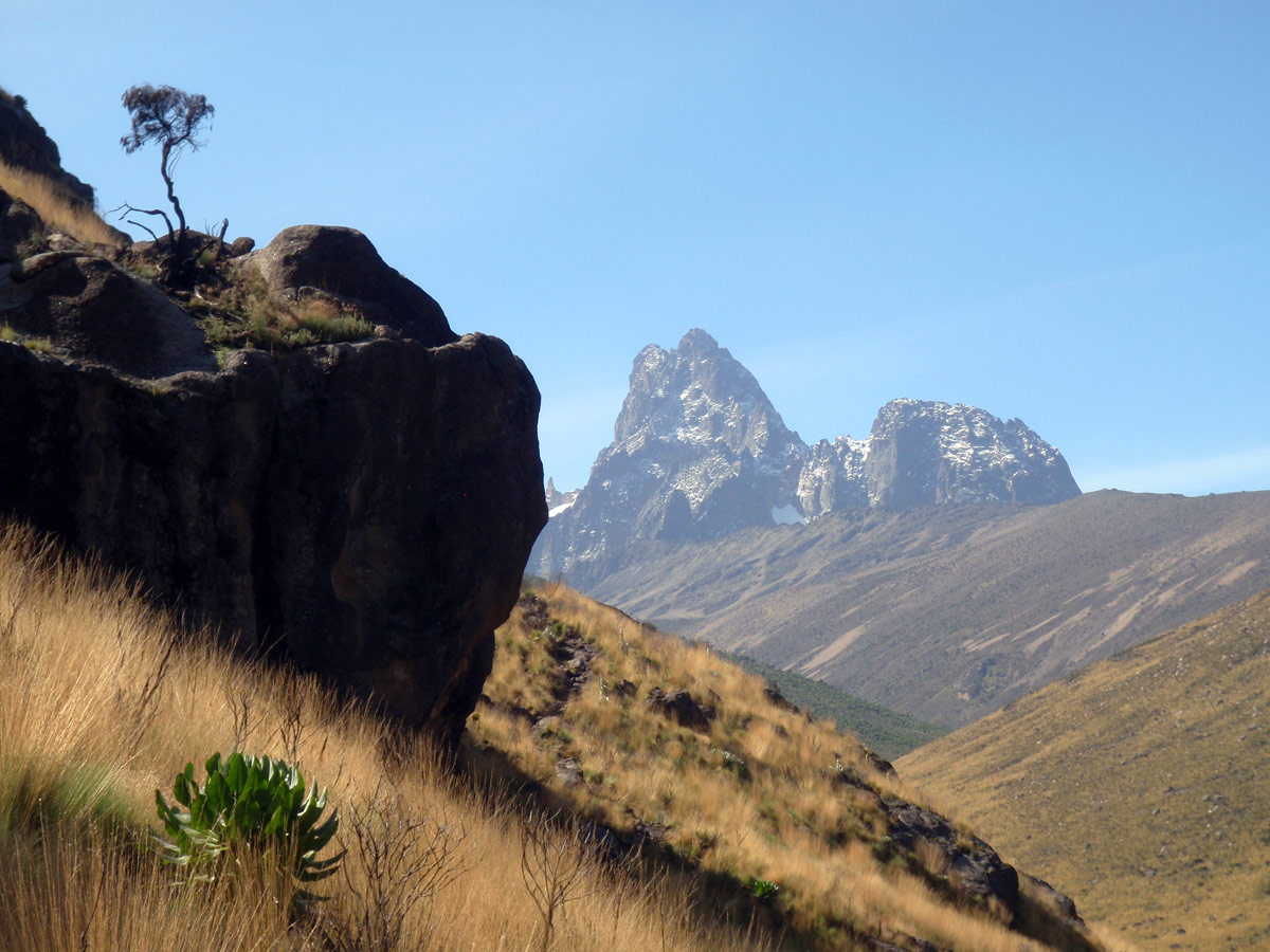
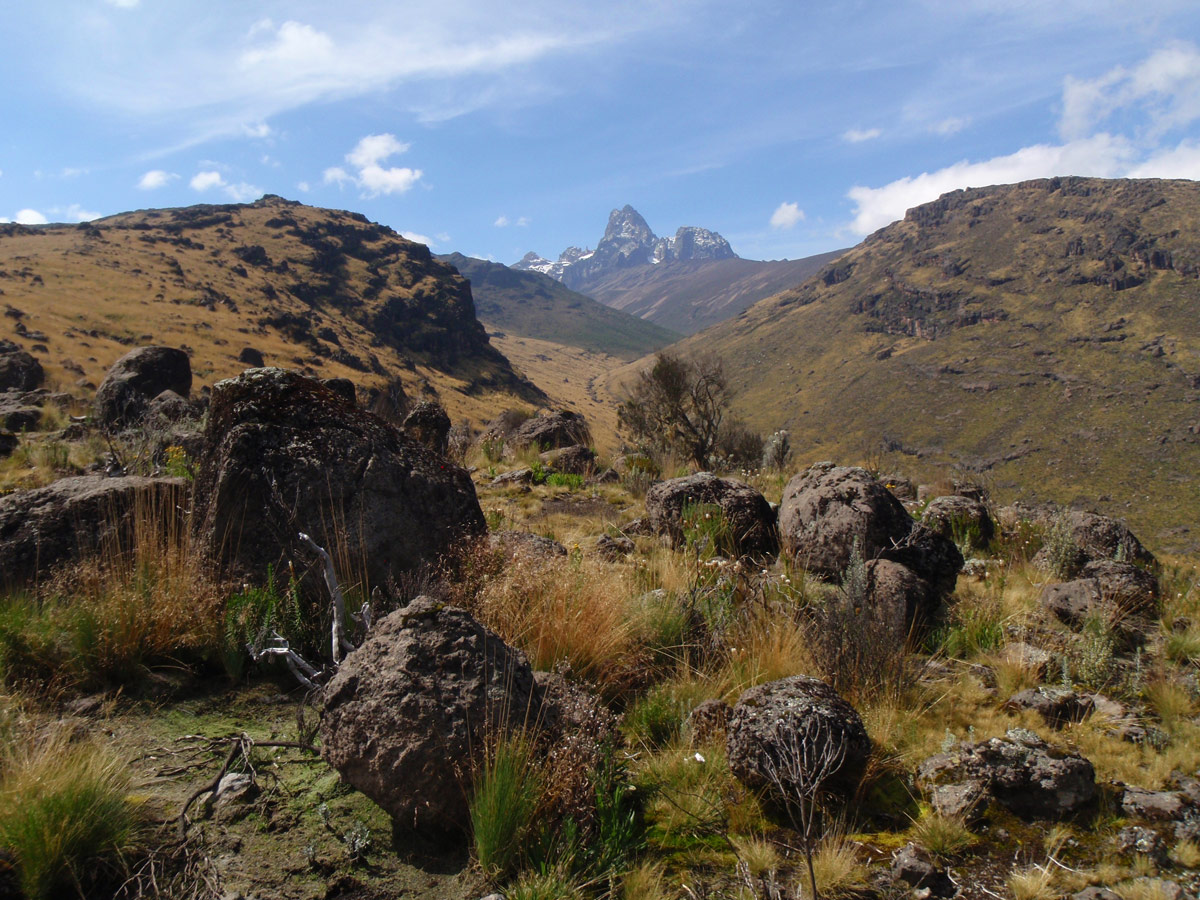
The path leading to the right crosses first the Ontulili stream and after crossing a small ridge also the Liki North stream. After climbing up another ridge there’s already the Mackinder Valley stretching along. Remain only 7 km on the east side of the valley along the Liki creek to Shipton camp.
The journey through the Liki North Camp heads towards the southwest edge of Barrow Hill (4192m) and then crosses the two streams mentioned above. Don’t expect a lot of comfort from the small hut, but there’s an ample opportunity for camping around. Further, the journey continues by overcoming the ridge and soon connects with the first route in the Mackinder valley.
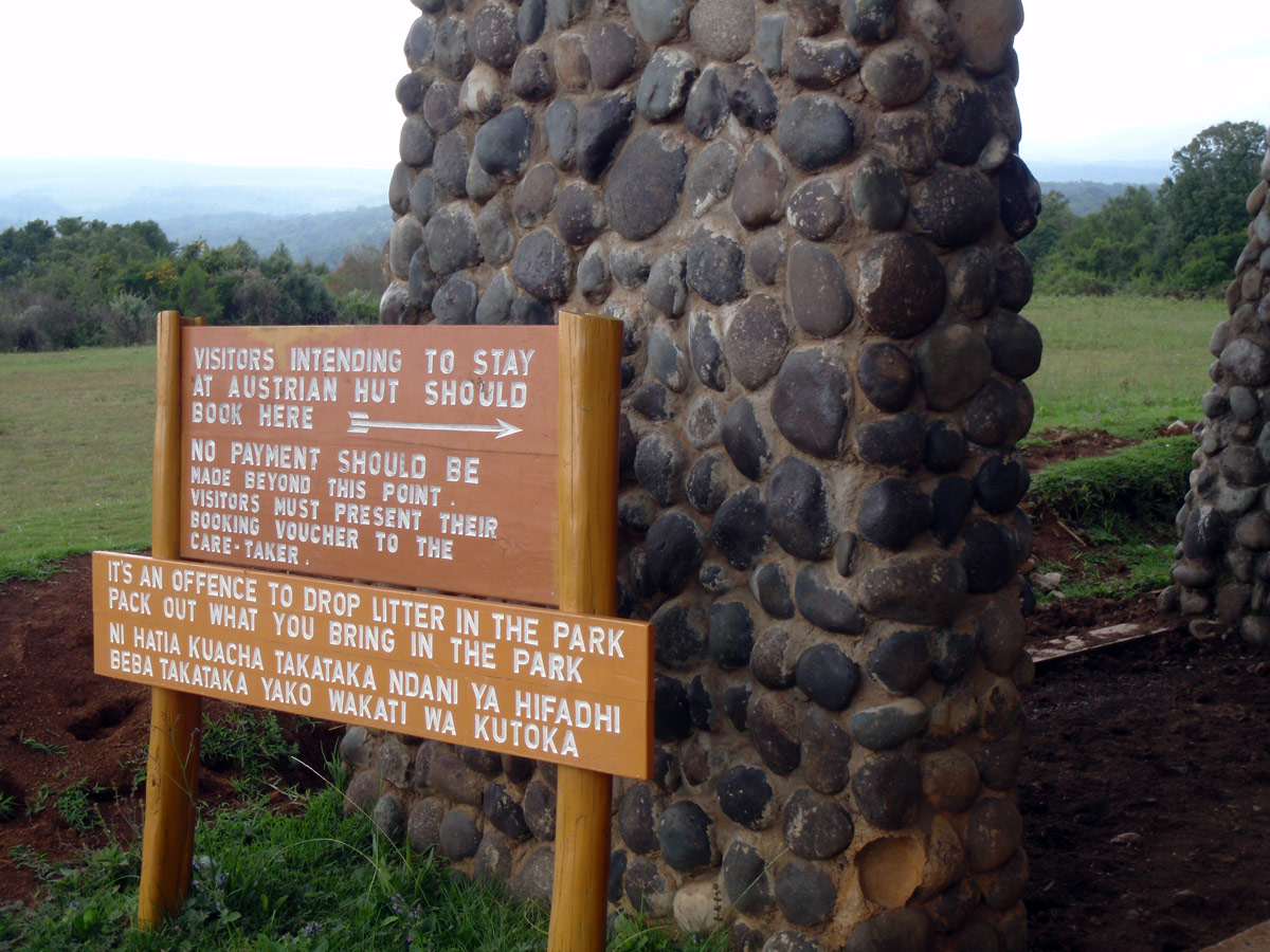
From Shipton camp you can continue direct south-southeast towards the Point Lenana (4985m) or slightly to the right to the Simba saddle (Simba Col - 4620 metres) to join with the Chogoria route and continue to Austrian Hut (4790m); or you can go left to the Kami campground (4425m), which lies just beneath the north wall of Batian by a small lake called Kami Tarn.
Our carriers called a jeep, so that we could get from the park gate to the town of Nanyuki (1980m). It's still a considerable distance. In the old Land Rover we pass perfectly maintained fields. No machinery, hard manual labour. People look very poor, but they all wear perfectly clean clothes. Unlike us. We are incredibly muddy and stinking.
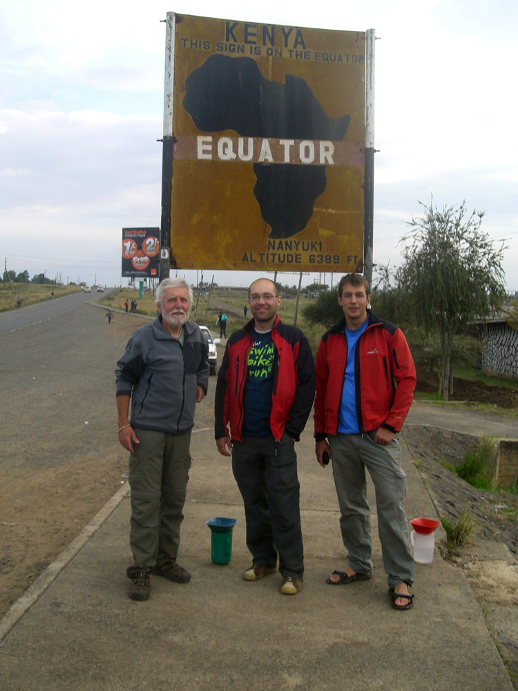
It didn’t disappoint. We take three rooms and pay only 1 000 KSH each, including breakfast! And finally, we tip our carriers who were waiting whether we choose their “commission-driven” offer of the other hotel. We are in an extremely good mood, so they get a nice tip - a total of 6000 KSH. After a generous lunch we go to town. We need to secure transport to Nairobi for tomorrow. The town walk proves unsuccessful and there’s nothing to do in Nanyuki. So we take a taxi and go to spread our legs across the equator, only three kilometers away.
Already when our taxi slowed down by the sign "the Equator" it was clear that we have a problem. Sellers of all possible and impossible rubbish souvenirs took our car by assault.
But our only interest was the equator itself. The only stuff that drew our attention was a set of two vessels with funnels. First we thought it’s just another trap for tourists. But Lada then searched his academic memory and the result was a distant recall of so called Coriolis force. Just a note concerning this from Wikipedia:
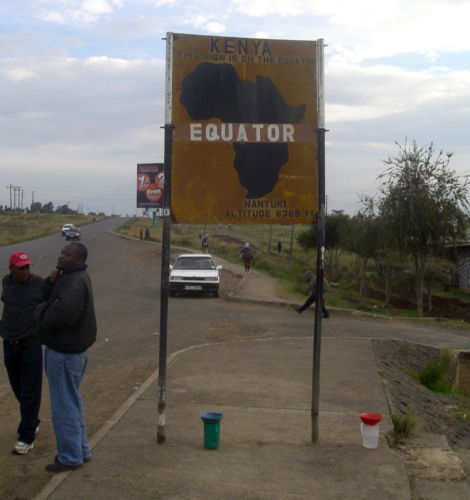
It is not true that due to the Coriolis effect water let out from a bath or sink spins always in one direction in the Northern Hemisphere and in the opposite in the Southern Hemisphere. In fact, the effect of the Coriolis force is a way too less important than various random influences (such as the shape of the container, the initial flow of water) and the effect is measurable only in laboratory conditions. The believe was spread by some TV series too (e.g. X-Files). Moreover, this incorrect statement appeared in several scientific programmes and publications. Source: Wikipedia.
Before dinner we managed to arrange our morning transfer to Nairobi. It was our taxi driver who helped. He drove us to the matatu station and in few moments the deal was closed. For 2800 KSH (7 seats at 400 KSH) we have a whole matatu for ourselves, including our driver Ben’s phone number. He will be waiting for us at 8:00 a.m. outside the hotel.
After fine meaty dinner, properly washed down by the Tusker beer, I swallow a few pain-killers and muscle relaxants – my leg doesn’t feel like walking...

Comments